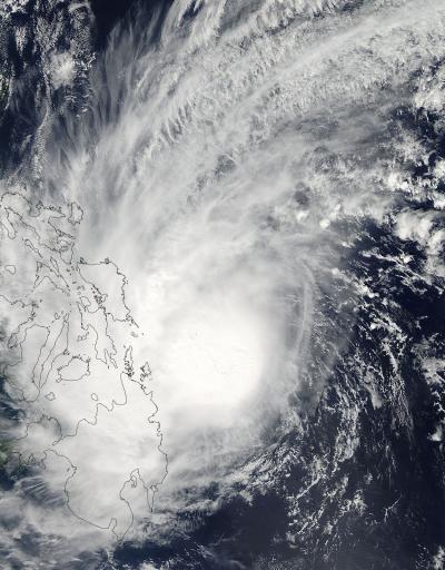
NASA's Aqua satellite captured one of the last images of Tropical Storm Kajiki as it began moving over the central Philippines on Jan. 31. The storm, known locally as Basyang, dissipated over the South China Sea today, Feb. 3.
On January 31 at 04:45 UTC/Jan. 30 at 11:45 p.m. EST, the Moderate Resolution Imaging Spectroradiometer known as the MODIS instrument that flies aboard NASA's Aqua satellite captured a visible image of Tropical Storm Kajiki. At the time Aqua was flying over the storm, it was making landfall in the Visayas region of the Philippines.
On February 1 at 0900 UTC/4 a.m. EST, the Joint Typhoon Warning Center issued its final bulletin on Kajiki. By that time, Kajiki had weakened to a depression and had maximum sustained winds near 30 knots/34.5 mph/55.5 kph. It was located about 171 nautical miles/196.8 miles/316.7 km south of Manila, Philippines, near 11.8 north latitude and 121.5 east longitude. At that time the depression was moving over Palawan. Palawan is an island province of the Philippines in the South China Sea.

On Jan. 31 at 04:45 UTC, the MODIS instrument aboard NASA's Aqua satellite captured this visible image of Tropical Storm Kajiki making landfall in Visayas, Philippines.
(Photo Credit: : NASA Goddard MODIS Rapid Response Team)
According to the Philippine Star, a passenger ship sank off of Camotes Island, Cebu killing one crewmember. Tropical Storm Kajiki displaced over 18,000 people into shelters.
Kajiki dissipated on February 3, 2014 in the South China Sea.
Source: NASA/Goddard Space Flight Center