Although Cristina had started a weakening trend TRMM's Precipitation Radar instrument still found rain falling at a rate of almost 97 mm (about 3.8 inches) per hour in the northwestern side of Cristina's eye wall. At Goddard, TRMM's PR data was used to create a 3-D view of the Cristina's rainfall structure. That 3-D image showed powerful thunderstorms in the northwestern side of the storm were reaching heights above 13.5 km (about 8.4 miles). These same TRMM data showed that Cristina's eye wall was broken on the eastern side.
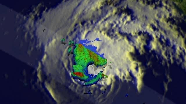
The passage of Cristina over cooler ocean waters and southwesterly wind shear resulted in the once powerful hurricane dissipating to a remnant low pressure area on Sunday, June 15, 2014.
On June 17 at 09:02 a.m. EDT, the National Hurricane Center (NHC) noted that the remnant low pressure center of Cristina continued to spin in the Eastern Pacific, and the circulation center was located near 23 north latitude and 117 west longitude. NHC forecasters noted that the circulation will continue to spin down over the next couple of days and is expected to dissipate by the night time hours on Wednesday, June 18.
On June 14, NASA's TRMM satellite found rain falling at a rate of almost 97 mm (about 3.8 inches) per hour in the northwestern side of Cristina's eye wall where thunderstorms reached above 13.5 km (about 8.4 miles).
(Photo Credit: Image : SSAI/NASA, Hal Pierce)
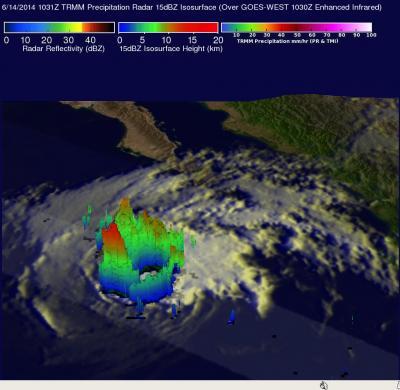
On June 14, NASA's TRMM satellite found rain falling at a rate of almost 97 mm (about 3.8 inches) per hour in the northwestern side of Cristina's eye wall where thunderstorms reached above 13.5 km (about 8.4 miles).
(Photo Credit: Image : SSAI/NASA, Hal Pierce)
Source: NASA/Goddard Space Flight Center