SAN FRANCISCO--The Greenland Ice Sheet is ready for its close-up.
The highest-resolution satellite images ever taken of that region are making their debut. And while each individual pixel represents only one moment in time, taken together they show the ice sheet as a kind of living body--flowing, crumbling and melting out to sea.
The Ohio State University has partnered with the Polar Geospatial Center at the University of Minnesota to turn images captured by DigitalGlobe's Worldview-1 and 2 satellites into publicly available elevation maps that researchers can use to track the ice.
Ian Howat, associate professor of earth sciences at Ohio State, presented the project's first data release in a poster session at the American Geophysical Union (AGU) meeting on Dec. 18, 2014.*
He called researchers' access to DigitalGlobe's imagery "one of the biggest breakthroughs for earth science satellite capabilities in decades," adding that "it's only been a few years since we've gotten access to really high-resolution imagery from government agencies, and we're already discovering new things about the ice sheet."
The imagery starts out at a resolution of about 0.5 meters. The researchers then turn it into digital elevation maps with a resolution of 2 meters.
With hundreds of terabytes of polar data already collected and additional surface area equivalent to the state of Missouri being collected every day, the researchers are steadily processing it all with new Ohio State software called SETSM (for Surface Extraction from TIN-based Search Minimization). Ohio State research associate Myoung-Jong Noh created the software, which builds 1-gigabyte "tiles" representing regions 7 kilometers on a side and assembles them into mosaics depicting land, sea and ice elevation.
Each tile is extracted from a pair of images acquired of the same region, but about 45 seconds apart. SETSM combines the two displaced images into a coherent whole, as our brain does when it combines images from our two eyes. SETSM uses the Worldview satellites' sensitivity to a very wide band of the electromagnetic spectrum to show things that our eyes alone couldn't see, including tiny changes in elevation.
As an example, Howat pointed to the portion of the mosaic showing Jakobshavn Glacier, the fastest-flowing glacier in the Greenland Ice Sheet. Icebergs that have calved off the edge of the glacier are visible floating out to sea--but so are cracks hundreds of kilometers inland from Jakobshavn, on what would otherwise be a flat expanse of ice.
The winding, parallel cracks, which resemble ridges on a fingerprint, are signs that the ice is accelerating, Howat explained. As the ice flows faster and approaches the sea, the surface gets stretched out and cracks open. Over time, the cracks widen. The situation is similar to cars on a highway, he explained: Cars may be bunched up when they first enter the highway from an on-ramp, but they gradually spread apart as they accelerate to highway speeds.
Any research that relies on measuring changes in the Earth's surface, including studies of volcanoes and coastal erosion, would benefit from elevation data produced by the SETSM software, Howat said. Applications for SETSM outside of earth science include computer vision, astronomy and national security--any job for which very large amounts of terrain are mapped at high resolution.

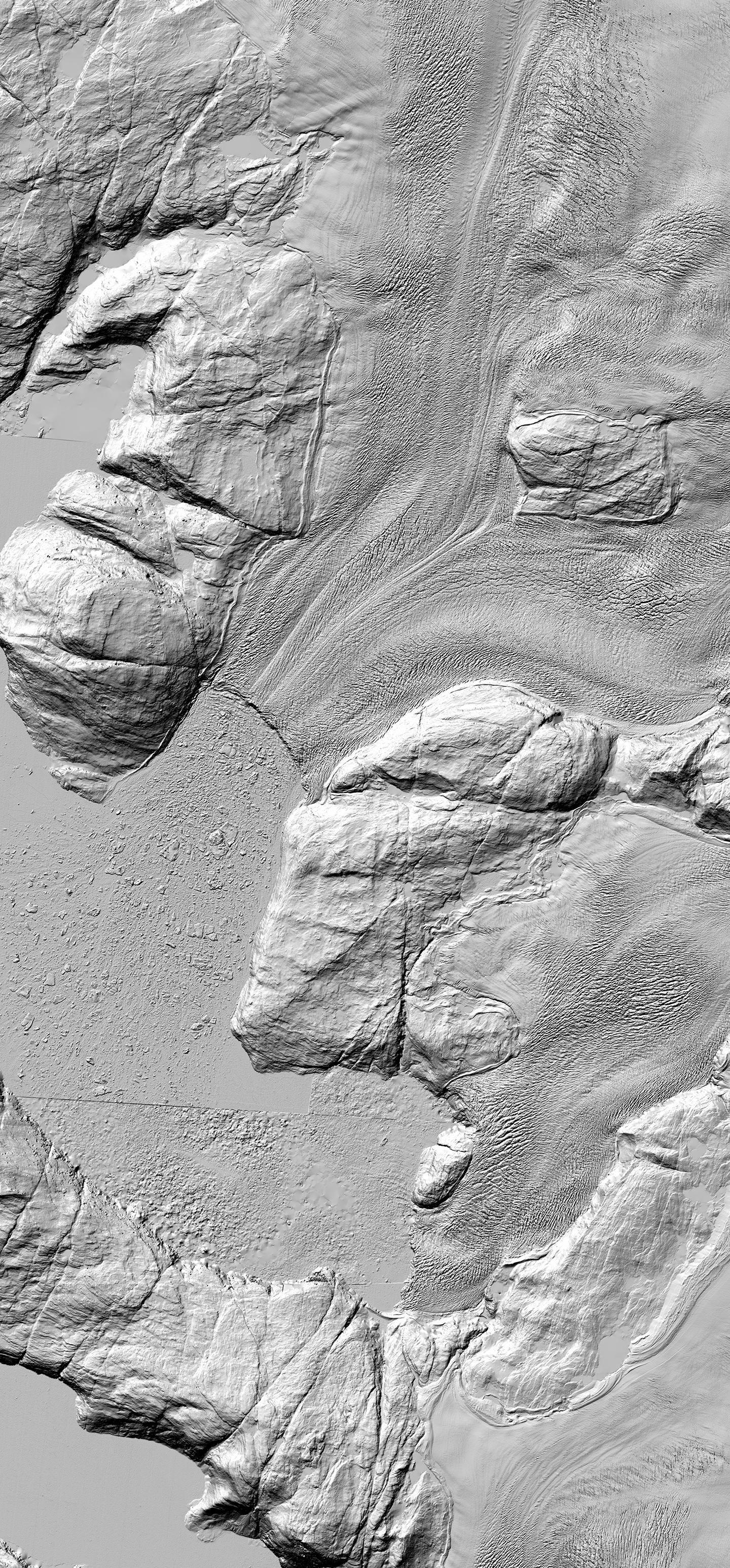
This elevation map of two outlet glaciers in Greenland is part of a setof maps created by researchers at The Ohio State University and theUniversity of Minnesota. The researchers took Worldview satellitedata and processed it with Ohio State software. The resulting maps,which made their debut at the American Geophysical Union meetingon Dec. 18, are the highest resolution elevation maps ever created ofthe study region, which so far covers part of Alaska and theGreenland Ice Sheet. Shown here are the outlet glaciers SermeqSilardleq (middle top) and Kangigdleq (middle bottom).
(Photo Credit: The Ohio State University and the University of Minnesota)
The mosaics debuting at AGU show southwest Greenland and some of the North Slope of Alaska. So far, the Ohio State team has finished processing images from about one quarter of the Greenland Ice Sheet, representing a tiny portion of the data already stored at Minnesota, and about one year's worth of work and computing for the research team.
The Greenland Survey, Asiaq, is already using SETSM to protect drinking water resources, where remote sensing specialist Eva Mätzler said it "strengthens the understanding of importance in reliable geographic data for the Greenlandic government and people." Asiaq project manager Bo Naamansen added that the software "is the best news for several decades when it comes to mapping Greenland and the Arctic."
Paul Morin, director the Polar Geospatial Center, offered more superlatives: He said that the work done with SETSM is truly revolutionary. "We are no longer limited by remote sensing data when producing elevation data at the poles," Morin said. "Noh and Howat have shown that we're really only limited by high-performance computing."
The Worldview satellite data is collected by commercial imagery vendor DigitalGlobe and licensed for U.S. federal use by the National Geospatial-Intelligence Agency, which in turn provides it to the Polar Geospatial Center at the University of Minnesota. At any given time, a 30-terabyte data subset is being stored and processed at Ohio State via the Ohio Supercomputer Center (OSC) before returning to Minnesota for distribution via a publicly accessible website.
Of the many Ohio State projects that draw upon OSC resources, SETSM is one of the largest. The researchers hope to expand the project to NASA's Pleiades supercomputer starting in 2015.

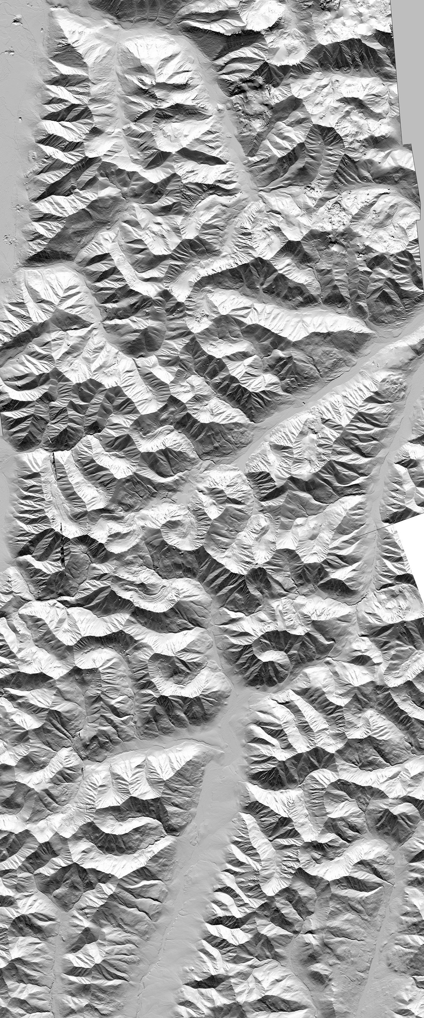
This elevation map of the Brooks Range Mountains in Alaska is part of aset of maps created by researchers at The Ohio State University and theUniversity of Minnesota. The researchers took Worldview satellite dataand processed it with Ohio State software. The resulting maps, whichmade their debut at the American Geophysical Union meeting on Dec. 18,are the highest-resolution elevation maps ever created of the studyregion, which so far covers part of Alaska and the Greenland Ice Sheet.
(Photo Credit: The Ohio State University and the University of Minnesota.)
Source: Ohio State University