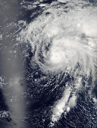
Tapah was downgraded from a tropical storm to a tropical depression and is located 239 nautical miles southeast of Iwo To. Tapah rapidly dissipated due to the effected of strong vertical windshear from the west and a sharp decreased in sea surface temperature. The storm is currently tracking northwest at 10 knots per hour and is expected to recurve to the northeast and accelerate. Maximum wave height is currently 10 feet. The storm will be monitored for signs of regeneration.
NASA captured this image of the storm with the Moderate Resolution Imaging Spectroradiometer or MODIS instrument aboard NASA's Aqua satellite on April 29, 2014 at 11:55 p.m. EDT (3:55 UTC) in the western Pacific Ocean.

Aqua captured this image of the tropical depression Tapah on April 29, 2014, at 11:55 p.m. EDT (3:55 UTC) in the western Pacific Ocean.
(Photo Credit: NASA Goddard's MODIS Rapid Response Team)
Source: NASA/Goddard Space Flight Center