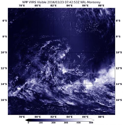
Former Tropical Cyclone Emeraude was battered by northeasterly vertical wind shear and reduced to a remnant low pressure area in the Southern Indian Ocean. NASA-NOAA's Suomi NPP satellite passed over the system on March 24 captured a visible image of the large area of remnant clouds.
On Mar. 24 at 07:42 UTC (3:42 a.m. EDT) the Visible Infrared Imaging Radiometer Suite (VIIRS) instrument aboard NASA-NOAA's Suomi NPP satellite captured a visible image of clouds associated with the remnant low pressure area. The poorly-defined center circulation was barely distinguishable in the imagery, although there were flaring thunderstorms occurring southwest of the center.
VIIRS collects visible and infrared imagery and global observations of land, atmosphere, cryosphere and oceans.
 On March 24 at 07:42 UTC (3:42 a.m. EDT), the VIIRS instrument aboard NASA-NOAA's Suomi NPP satellite captured this visible image of the remnant clouds of former tropical cyclone Emeraude. Credit: Credits: NASA Goddard Rapid Response/NOAA
At 1800 UTC (2 p.m. EDT), the remnants of Emeraude were centered near 11.0 degrees south latitude and 85.9 degrees east longitude, about 650 nautical miles (748 miles/1,204 km) west of Cocos Island. Maximum sustained surface winds were estimated at 20 to 25 knots (23.0 to 28.7 mph/37.0 to 46.3 kph) and the minimum sea level pressure was estimated to be near 1005 millibars.
The Joint Typhoon Warning Center noted that "upper level environment remains poor with weak divergence and strong vertical wind shear between 25 to 30 knots (28.7 to 34.5 mph/46.3 to 55.5 kph). Development is not expected over the next 24 to 48 hours, however, some dynamic models re-develop the system beyond two days."
source: NASA/Goddard Space Flight Center