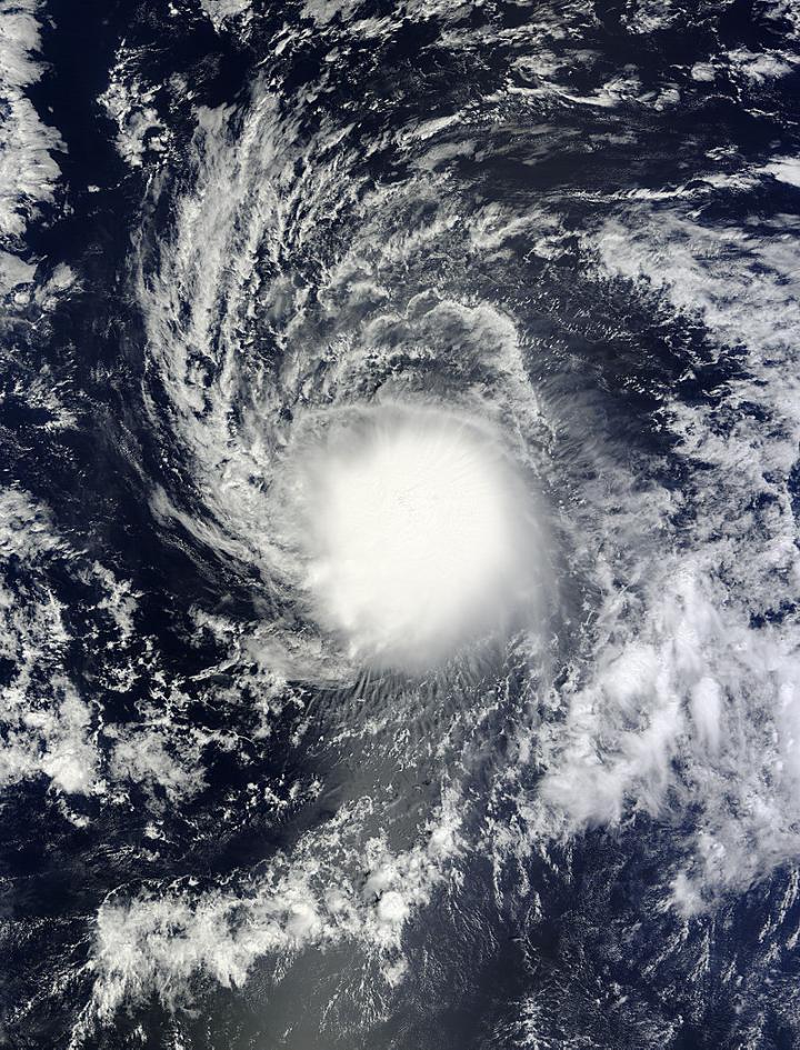
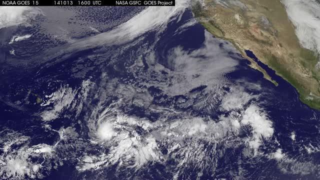
Tropical Storm Ana continued on a path to the Hawaiian Islands as NASA's Terra satellite passed overhead and gathered data on the storm. NOAA's GOES-West satellite data was compiled into a movie that showed the intensification and movement of Ana. Watches are now in effect for Hawaii.
NOAA's Central Pacific Hurricane Center (CPHC) has issued a Tropical Storm Watch for Hawaii County, Hawaii. A tropical storm watch means that tropical storm conditions are possible within the watch area, in this case within 36 to 48 hours. Life-threatening surf and riptide conditions will start to affect the Hawaiian Islands from Thursday onwards. Heavy rainfall will reach the Big Island on Friday, causing life-threatening flash floods and mud slides.
Interests elsewhere in the main Hawaiian Islands, and in the Papahanaumokuakea marine national monument area from Necker to French Frigate Shoals, should monitor the progress of Ana. Watches May be required for additional areas in the main Hawaiian Islands later today.
CPHC noted that tropical storm conditions are possible on the Big Island of Hawaii starting late Friday, Oct.17. In addition, large swells produced by Ana are possible over the eastern end of the main Hawaiian island chain starting late tonight and Friday morning. These large swells will continue to spread up the island chain through the weekend. Surf produced by these swells could potentially be damaging along exposed shorelines beginning late Friday and Saturday, and persisting through the weekend in some areas. Heavy rainfall associated with Ana may reach the Big Island of Hawaii Friday afternoon. These rains could cause life-threatening flash floods and mud slides.
At the NASA/NOAA GOES Project office at NASA's Goddard Space Flight Center in Greenbelt, Maryland, infrared and visible image of Tropical Storm Ana were compiled from Oct. 13 through Oct. 16 and made into a movie that showed the intensification and movement of Ana. NOAA manages the GOES-West satellite.
NASA's Terra satellite passed over Tropical Storm Ana on Oct. 15 at 20:30 UTC (4:30 p.m. EDT) and the Moderate Resolution Imaging Spectroradiometer captured a visible image of the storm that showed extent of the rounded clouds. The storm appeared so rounded that it looked like a white sun.
At 500 a.m. HST (9 a.m. EDT/1500 UTC) on Oct. 16, Ana's maximum sustained winds were near 60 mph (95 kph) and gradual strengthening is expected and Ana is expected to become a hurricane on Friday, Oct. 17.
The center of Tropical Storm Ana was located near latitude 14.1 north, longitude 150.3 west. That's about 500 miles (805 km) east-southeast of Hilo, Hawaii. Ana is moving toward the west near 10 mph (17 kph) and is expected to turn to the northwest on Oct. 17. The estimated minimum central pressure is 1000 millibars.
Ana is forecast to move to the west-northwest and strengthen into a hurricane, approaching the big island of Hawaii by Saturday, Oct. 18 and then tracking parallel to the islands over the two days following. For updated forecasts, visit: http://www.prh.noaa.gov.

On Oct. 15 at 20:30 UTC (4:30 p.m. EDT) NASA's Terra satellite captured this image of Tropical Storm Ana in the Central Pacific Ocean.
(Photo Credit: Image : NASA Goddard MODIS Rapid Response Team)

This animation of NOAA's GOES-West satellite data from Oct.13-16 shows the intensification and movement of Ana in the Central Pacific Ocean.
(Photo Credit: Image : NASA/NOAA GOES Project)
Source: NASA/Goddard Space Flight Center