The remnants of Tropical Cyclone Bakung continue to linger in the Southern Indian Ocean, and NOAA-NASA's Suomi NPP (Suomi NPP) satellite is one satellite keeping an eye on the storm for possible re-development.
On Dec. 16, the remnant low pressure area formerly known as Bakung was centered near 7.4 south longitude and 83.8 east latitude. That's about 670 nautical miles (771 miles/1,241 km) east of the coral atoll known as Diego Garcia. The atoll is part of the British Indian Ocean Territory.
At 07:31 UTC (2:31 a.m. EST) NOAA-NASA's Suomi NPP satellite passed over Bakung's remnants and the Visible Infrared Imaging Radiometer Suite (VIIRS) instrument aboard captured a visible picture of the storm. The VIIRS instrument revealed fragmented thunderstorms southeast and northwest of the ill-defined and elongated low-level center of circulation.
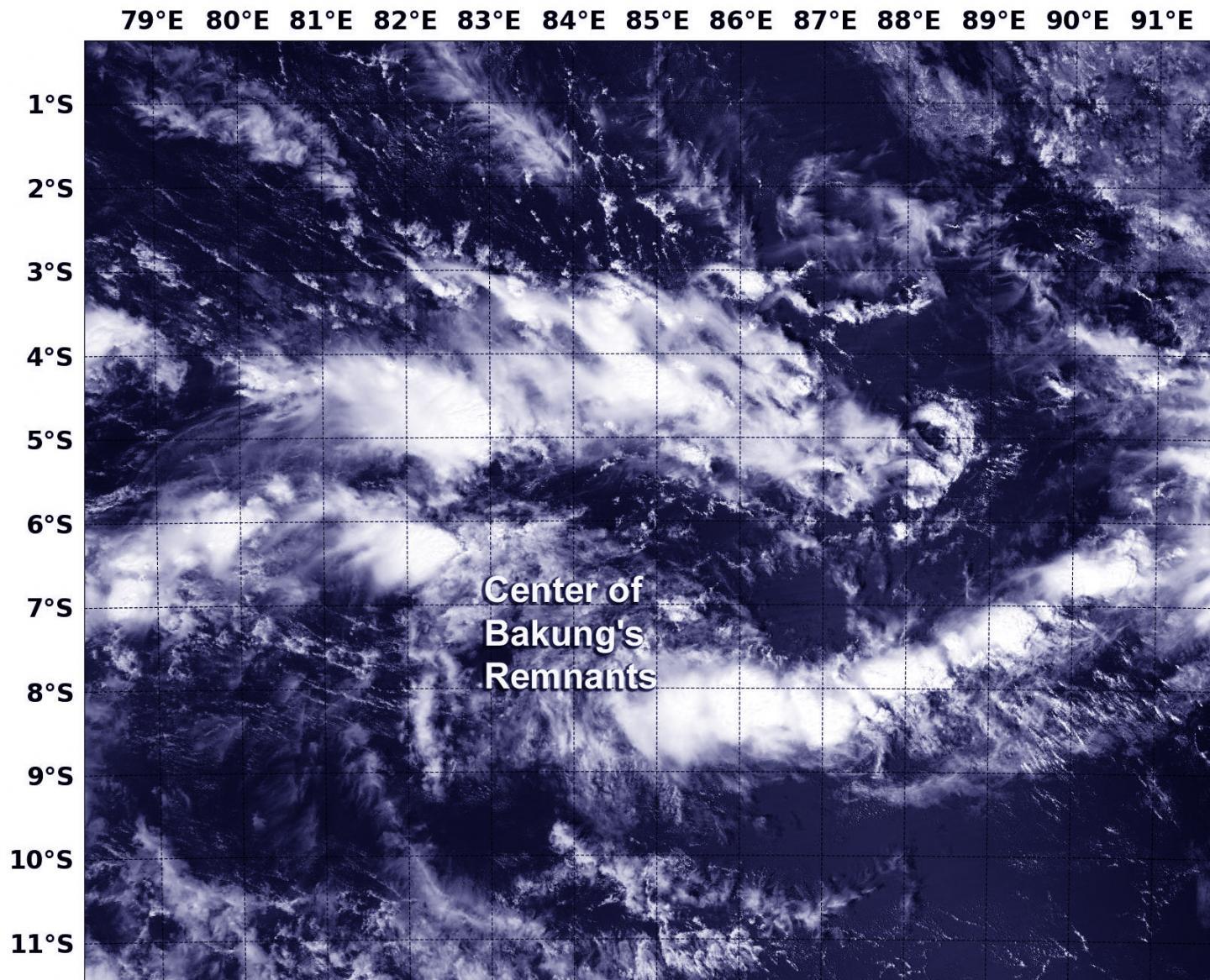
NOAA-NASA's Suomi NPP satellite passed over Bakung's remnants on Dec. 16 at 07:31 UTC (2:31 a.m. EST) and the VIIRS instrument captured this image of it.
(Photo Credit: Image : NOAA/NASA/NRL)
Suomi NPP's job is to collect environmental observations of atmosphere, ocean and land for both NOAA's weather and oceanography operational missions and NASA's research mission to continue the long-term climate record to better understand the Earth's climate and long-term trends.
The Joint Typhoon Warning Center (JTWC) noted that surface winds are estimated between 20 and 25 knots (23.0 and 28.7 mph/37.0 and 46.3 kph, and sea level pressure is near 1007 millibars. JTWC gives this low pressure area a low chance for development.
Source: NASA/Goddard Space Flight Center