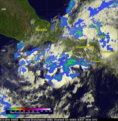
At 2 p.m. EDT, the National Hurricane Center update noted that showers and thunderstorms associated with a low pressure area became better organized during the morning hours. System 93E is located 250 miles south-southeast of Salina Cruz, Mexico,
Because the environmental conditions are conducive for additional development, The National Hurricane Center expects a tropical depression may likely form later today or tonight as the low moves slowly northeastward or northward.
Even though the low has not yet become a depression, the National Hurricane Center reported that it continues to bring very heavy rainfall to portions of western Central America, and is expected to spread over southeastern Mexico during the next couple of days. These rains could cause life-threatening flash floods and mud slides in areas of mountainous terrain.
As of June 2 at 2 p.m. EDT (11 a.m. EDT), the National Hurricane Center gives System 93E a 90 percent chance of becoming tropical depression 2E in the next 48 hours.

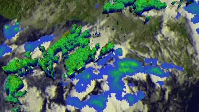
This 3-D animated fly-by of developing tropical low pressure System 93E on June 2 revealed the highest thunderstorms (in red) as it continues to develop.
(Photo Credit: SSAI/NASA, Hal Pierce)

This image of developing tropical low pressure System 93E on June 2 revealed the highest thunderstorms (in red) as it continues to develop. TRMM saw the heaviest rainfall was 115.8 mm (4.6 inches) per hour in another area of disturbed weather over Belize.
(Photo Credit: SSAI/NASA, Hal Pierce)
Source: NASA/Goddard Space Flight Center