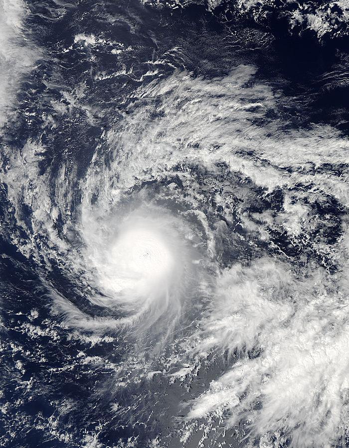
NASA's Aqua satellite passed over intensifying Tropical Storm Ana as it was moving through the Central Pacific Ocean and toward the Hawaiian Islands.
On Oct. 14 at 22:50 UTC (6:50 p.m. EDT) the MODIS instrument aboard NASA's Aqua satellite captured a visible image of Tropical Storm Ana in the Central Pacific Ocean. The MODIS image showed a tight concentration of thunderstorms surrounding the center of Ana's circulation.
At 1500 UTC (11 a.m. EDT/5 a.m. HST) on Wed. Oct. 15, Tropical Storm Ana's maximum sustained winds were near 70 mph (110 kph). Ana is forecast to gradually intensify through Thursday night, and it may become a hurricane later today or tonight, according to the Central Pacific Hurricane Center.

On Oct. 14 at 22:50 UTC (6:50 p.m. EDT) NASA's Aqua satellite captured this image of Tropical Storm Ana in the Central Pacific Ocean.
(Photo Credit: : NASA Goddard MODIS Rapid Response Team)
The center of tropical storm Ana was located near latitude 14.3 north, longitude 146.5 west. That's about 680 miles (1095 km) southeast of Hilo, Hawaii. Ana is moving toward the west near 9 mph (15 kph), and this general motion is expected to continue today, with a gradual turn toward the west northwest expected tonight or early Thursday, and this motion is expected to continue through late Thursday.
Ana is expected to begin causing life-threatening surf and riptide conditions through the Hawaiian Islands beginning Thursday, Oct. 16. CPHC noted that surf produced by these swells may be potentially damaging along some shorelines starting on Friday. There are no coastal watches or warnings in effect, however, a hurricane watch may be required for portions of the main Hawaiian Islands later today or tonight (Oct. 15).
Ana is moving northwest and intensifying. The CPHC expects Ana to become a hurricane late on Oct. 15. By the weekend of Oct. 18-19, Ana is forecast to approach the main Hawaiian Islands.
Source: NASA/Goddard Space Flight Center