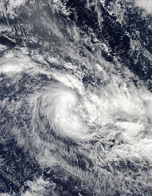
NASA's Aqua satellite passed over Tropical Cyclone 18P soon after it formed west of Vanuatu in the Southern Pacific Ocean and captured a visible image of the storm.
On April 5 at 02:40 UTC (April 4 at 10:40 p.m. EDT), the Moderate Resolution Imaging Spectroradiometer or MODIS instrument aboard NASA's Aqua satellite captured a visible image of the newborn Tropical Cyclone 18P in the Southern Pacific Ocean west of Vanuatu. Strong thunderstorms circled the center of the tropical storm, and a wide, thick band of thunderstorms wrapped into the center from the south.
At 0900 UTC (5 a.m. EDT) on April 5, Tropical Cyclone 18P had maximum sustained winds near 35 knots (40 mph/62 kph). Tropical Cyclone 18P was centered near 5.3 degrees south latitude and 167.3 east longitude, moving over the northern section of the island of Espiritu Santo. 18P is about 718 nautical miles (826.8 miles/1,331 km) west-northwest of Suva, Fiji, has tracked east-southeastward at 18 knots (20.1 mph/33.3 kph).
 On April 5 at 02:40 UTC (April 4 at 10:35 p.m. EDT) the MODIS instrument aboard NASA's Aqua satellite captured a visible image of the newborn Tropical Cyclone 18P in the Southern Pacific Ocean west of Vanuatu. Credit: Credits: NASA/NRL
The Joint Typhoon Warning Center forecast calls for Tropical Cyclone 18P to move east-southeast, cross Vanuatu and track just south of Fiji on April 6, bringing gusty winds, heavy rainfall and rough surf. 18P is expected to strengthen to 50 knots (57.5 mph/92.6 kph) on April 6 before weakening again. By April 7, the storm is expected to pass just north of the island of Tonga and run into increasing vertical wind shear which will weaken the tropical cyclone.
source: NASA/Goddard Space Flight Center