NASA's Hurricane and Severe Storms Sentinel, or HS3, mission investigated four tropical cyclones in the 2014 Atlantic Ocean hurricane season: Cristobal, Dolly, Edouard and Gonzalo. The storms affected land areas in the Atlantic Ocean Basin and were at different stages during the investigations.
The HS3 mission pilots flew a remotely piloted Global Hawk aircraft over Cristobal, Dolly, and Edouard and flew a manned WB-57 aircraft over Gonzalo. During the flights, Cristobal transitioned from a hurricane into an extra-tropical storm. Edouard strengthened from a tropical storm into a strong Category-2 hurricane during the Global Hawk fly-overs. Gonzalo was a major Categories 3 and 4 hurricane when NASA's WB-57 investigated.
"Despite forecasts for a below-normal hurricane season, 2014 became our best deployment year of the mission by providing us with four storms, two of which became major hurricanes," said Dr. Scott Braun, HS3 Mission Principal Investigator from NASA's Goddard Space Flight Center in Greenbelt, Maryland.
The HS3 mission was based out of NASA's Wallops Flight Facility in Wallops Island, Virginia, for the third year to investigate the processes that underlie hurricane formation and intensity change in the Atlantic Ocean basin.
Hurricane Cristobal Became an Extra-Tropical Storm
NASA's Global Hawk No. 872 aircraft flew over Hurricane Cristobal on Aug. 26 and 27 when it was a Category 1 hurricane northeast of the Bahamas and again on Aug. 28 and 29 when the storm was transitioning into an extra-tropical system. Storms become extra-tropical when the warm air at the storm center is replaced by colder air and the storm begins to resemble a mid-latitude low pressure system.
Tropical Storm Cristobal became a hurricane late on Aug. 25 as it moved through the Bahamas. A rainfall analysis using data from NASA-JAXA's Tropical Rainfall Measuring Mission, or TRMM, satellite showed heavy rainfall over the Dominican Republic and Puerto Rico that exceeded 275 mm (10.9 inches). The satellite analysis found the greatest rainfall totals during that period along Cristobal's track near the Turks and Caicos Islands where rainfall was over 350 mm (13.8 inches). After drenching the eastern Caribbean, Cristobal moved north and intensified into a hurricane, eventually passing to the west of Bermuda.
During the Global Hawk's 24-hour mission on Aug. 28 - 29, the aircraft flew a "lawnmower," or back-and-forth, pattern over Hurricane Cristobal while gathering data using dropsondes and two other instruments. A dropsonde is a device that measures winds, temperature, pressure and humidity as it falls from the aircraft to the surface.
The aircraft released 69 dropsondes over Hurricane Cristobal.
The dropsonde data showed maximum low-level winds of 85 - 90 knots (97.8 to 103.6 mph/157.4 to 166.7 kph) just east and northwest of the center of circulation (near 49 degrees west longitude and 43.5 north latitude). These strong winds were located 124 to 186 miles (200 to 300 km) from the storm center, suggesting a shift of the strongest winds outward from the center compared to earlier stages in Cristobal's lifecycle.
Dropsonde data also revealed that very dry air was rapidly moving eastward across the western and southern sides of the storm as it made its transition.
On Aug. 29, satellite imagery showed Hurricane Cristobal racing through the North Atlantic while losing its tropical characteristics. For more storm history on Cristobal, visit: http://www.nasa.gov/content/goddard/cristobal-atlantic-ocean
Dolly Makes Landfall in Mexico
At 11 p.m. EDT on September 2, Dolly made landfall between Tampico and Cabo Rojo, near latitude 21.9 north and longitude 97.7 west.
NASA's unmanned Global Hawk aircraft flew over Tropical Storm Dolly on Sept. 2 and Sept. 3 and gathered wind and other data.
"We saw winds at low levels (near 850 millibars) up to about 35 to 40 knots (40 to 46 mph) and a reasonably depicted cyclonic circulation," Braun said. "The data at 150 millibars (high in the atmosphere) showed strong outflow from the storm to the east and southeast."
Edouard Became a Hurricane
NASA's HS3 mission pilots operated the unmanned Global Hawk aircraft on two two-day flights on Sept. 11 and Sept. 15 into Hurricane Edouard and scored a bullseye by gathering information in the eye of the strengthening storm.
During the Sept. 11 - 12 flight over Tropical Storm Edouard, the wind field at 800 millibars (about 2 kilometers or 1.2 miles above the surface) showed a well-organized cyclonic circulation with winds of at least 35 knots (40.2 mph/64.8 kph) on the eastern side of the storm. A dropsonde near the center suggested low-level warming and drying associated with sinking air motions, suggesting the formation of a nascent eye. In addition, scientists saw how upper-level wind shear and dry air was limiting Edouard's ability to strengthen.
During the Sept. 14-15 flight, the data from the Global Hawk revealed a storm that was quickly intensifying from a tropical storm to a Category-2 intensity storm. Compared to an earlier NOAA P-3 Orion flight, the Global Hawk data showed a pressure fall at the center of more than 11 millibars and an increase in maximum winds of at least 10 knots (11.5 mph/18.5 kph) in just four hours.
The Global Hawk overflew the hurricane again on Sept. 16-17 when it was near maximum intensity as a strong Category-2 storm and one last time on Sept. 18-19 when the storm rapidly weakened into a tropical storm after crossing the Atlantic, affecting the western Azores Islands over the weekend of Sept. 20.
For the entire storm history on Edouard, visit: http://www.nasa.gov/content/goddard/td6-atlantic-ocean/
Gonzalo Was a Major Hurricane
Tropical Storm Gonzalo strengthened into a hurricane on Oct. 14 when it was near Puerto Rico and provided a natural laboratory for two of three HS3 over-storm instruments, which had been moved to the manned WB-57 aircraft after problems arose with HS3's second Global Hawk aircraft.
The WB-57 aircraft flew over Hurricane Gonzalo on Oct. 15 carrying instruments called HIWRAP and HIRAD in addition to a new Office of Naval Research sponsored dropsonde system.
The WB-57 is a mid-wing, long-range aircraft capable of operation for short (up to 6 hours) periods of time from sea level to altitudes in excess of 60,000 feet.
When the WB-57 investigated Gonzalo it ranged from a Category 3 to 4 intensity storm on the Saffir-Simpson Hurricane Scale. According to the National Hurricane Center, Gonzalo was the first Category 4 hurricane in the Atlantic basin since Ophelia in 2011.
Hurricane Gonzalo weakened to a Category 2 storm before it passed directly over Bermuda on Friday, Oct. 17, 2014, causing flooding and damage to many structures. The remnants of Gonzalo also pounded the British Islands with winds exceeding 70 mph causing the death of at least one person.
For the entire storm history of Gonzalo, visit: http://www.nasa.gov/content/goddard/gonzalo-atlantic-ocean/
About the HS3 Mission
The HS3 mission is funded by NASA Headquarters and overseen by NASA's Earth System Science Pathfinder Program at NASA's Langley Research Center in Hampton, Virginia. It is one of five large airborne campaigns operating under the Earth Venture program.
The HS3 mission also involves collaborations with partners including the National Centers for Environmental Prediction, Naval Postgraduate School, Naval Research Laboratory, NOAA's Unmanned Aircraft System Program, Hurricane Research Division and Earth System Research Laboratory, Northrop Grumman Space Technology, National Center for Atmospheric Research, State University of New York at Albany, University of Maryland - Baltimore County, University of Wisconsin, and University of Utah. The HS3 mission is managed by the Earth Science Project Office at NASA Ames Research Center in Moffett Field, California.

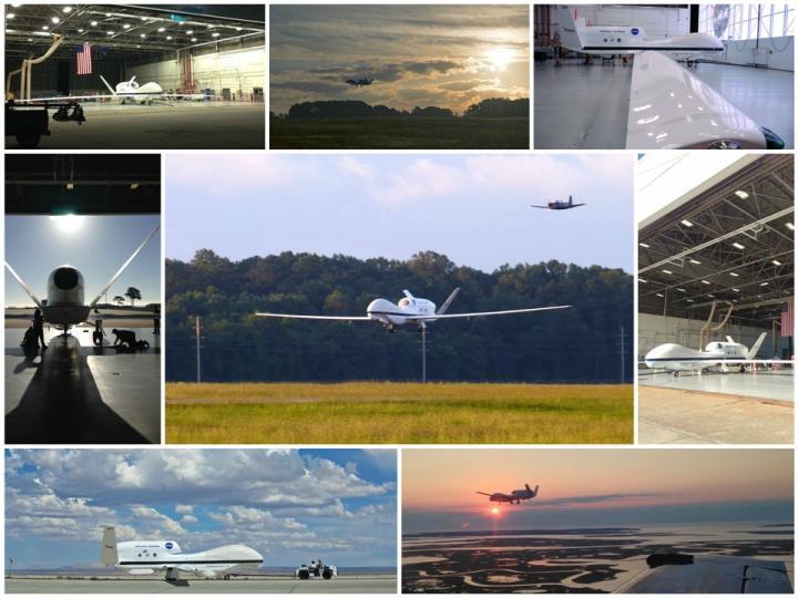
This is a collage of Global Hawk photos taken during the 2014 mission.
(Photo Credit: NASA/ Brian Kelly and Erin Czech)
The Global Hawk aircraft are maintained and based at NASA's Armstrong Flight Research Center in Edwards, California. The WB-57 is housed at NASA's Johnson Space Center in Houston home of the NASA WB-57 High Altitude Research Program.
The Atlantic Ocean Hurricane season may end on Nov. 30, but over the next couple of years, scientists will comb through the data to uncover the secrets behind these tropical transitions.

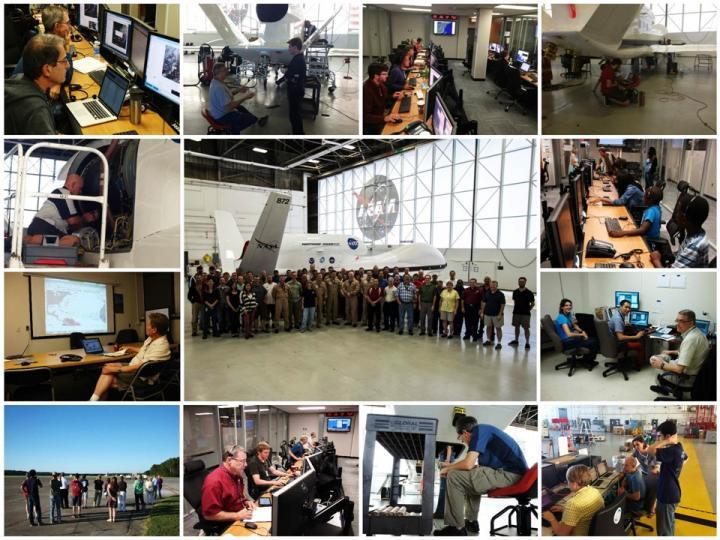
This is a collage of HS3 mission personnel taken during the 2014 mission.
(Photo Credit: NASA/ Brian Kelly and Erin Czech)
Source: NASA/Goddard Space Flight Center