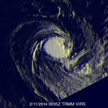
TRMM's Precipitation Radar (PR) instrument data was used to create a 3-D image of the storm. Those data found a few of the powerful storms near FOBANE's center were reaching heights of over 14 km/~8.7 miles.
At 0900 UTC/4 a.m. EST on February 11, Fobane's maximum sustained winds had dropped to 45 knots/51.7 mph/83.3 kph. Fobane was far from land areas and centered near 24.5 south and 66.9 east, about 602 nautical miles/692.8 miles/1,115 km east-southeast of Port Louis, Mauritius. Fobane is moving to the south-southwest at 9 knots/10.3 mph/16.6 kph and is expected to continue weakening.
The Joint Typhoon Warning Center expects Fobane to dissipate over the next day or two.
This TRMM flyover is a simulated 3-D view of Fobane that shows a few powerful thunderstorms near the center were reaching heights of over 14km (~8.7 miles) on Feb. 11.
(Photo Credit: SSAI/NASA, Hal Pierce)
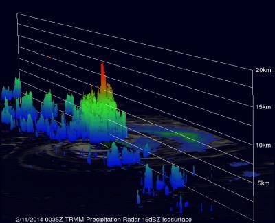
This is a simulated 3-D view using data from TRMM's Precipitation Radar instrument. It shows a few powerful storms near Fobane's center were reaching heights of over 14km (~8.7 miles) on Feb. 11.
(Photo Credit: SSAI/NASA, Hal Pierce)
Source: NASA/Goddard Space Flight Center