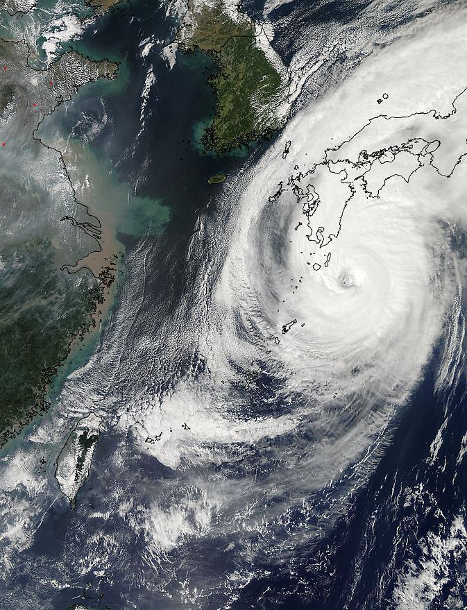
Over the weekend of Oct. 5 and 6, Typhoon Phanfone's center made landfall just south of Tokyo and passed over the city before exiting back into the Northwestern Pacific Ocean. NASA's Aqua satellite captured a picture of the typhoon as Tokyo braced for its large eye.
On its way to mainland Japan, Phanfone struck Kadena Air Base on the island of Okinawa. According to the website for U.S. Air Force Kadena Air Base, "One Airman is confirmed deceased and two more are missing after they were washed out to sea from the northwest coast of Okinawa at about 3:45 p.m. Oct. 5. An Airman that was found by the Japanese Coast Guard and pulled from the sea was later pronounced dead at a local hospital. HH-60s from Kadena Air Base and Japanese Coast Guard are continuing to search for the remaining two Airmen. Rough seas are complicating rescue efforts."
Typhoon Phanfone's large eye made landfall near the city of Hamamatsu on Oct. 5 around 8 a.m. local time and then tracked north before turning eastward into the Pacific Ocean north of Tokyo.

NASA's Aqua satellite captured this image of Typhoon Phanfone approaching Japan on Oct. 5 at 12:55 a.m. EDT.
(Photo Credit: NASA's Goddard Space Flight Center)
The MODIS instrument known as the Moderate Resolution Imaging Spectroradiometer captures amazing pictures from its orbit aboard NASA's Aqua satellite. MODIS snapped a picture of Typhoon Phanfone approaching Japan on Oct. 5 at 12:55 a.m. EDT. At that time, the Typhoon had already passed north of Okinawa, and was just south of the large island of Kyushu. The MODIS image revealed a large eye with powerful bands of thunderstorms spiraling into the center.
On Oct. 6 by 0900 UTC (5 a.m. EDT), Phanfone had weakened from a typhoon to a tropical storm back over open waters of the Northwestern Pacific Ocean. Maximum sustained winds were near 60 knots (69.0 mph/111.1 kph). Phanfone was located near 38.0 north longitude and 145.0 east latitude. That's about 201 nautical miles (271 miles/372 km) south-southeast of Misawa Air Base, Japan. Phanfone was moving to the northeast at 40 knots (46 mph/74 kph).
Forecasters at the Joint Typhoon Warning Center (JTWC) using animated multispectral satellite imagery noted that Phanfone is being affected by strong wind shear. The wind shear has stretched the tropical storm out, and pushed the bulk of thunderstorms northeast of the center. In addition, Phanfone has transitioned into an extra-tropical storm, which means that its core transitioned from warm to cold.
JTWC called for Phanfone to continue accelerating northeastward and weaken as an extra-tropical cyclone over water.
Source: NASA/Goddard Space Flight Center