Typhoon Nuri continued moving in a northeasterly direction passing the island of Iwo To, Japan when NASA's Aqua satellite passed overhead.
The Moderate Resolution Imaging Spectroradiometer or MODIS instrument that flies aboard NASA's Aqua satellite captured a visible picture of Typhoon Nuri on Nov. 5 at 4:10 UTC (11:10 p.m. EST, Nov. 4).
At 1002 UTC (5:02 a.m. EST) a microwave image captured from NASA/JAXA's Tropical Rainfall Measuring Mission or TRMM satellite showed that the low-level center of circulation was beginning to weaken. The strongest thunderstorms had become isolated in the northern quadrant of the storm. Regardless, a weak eye still appeared on the microwave imagery.
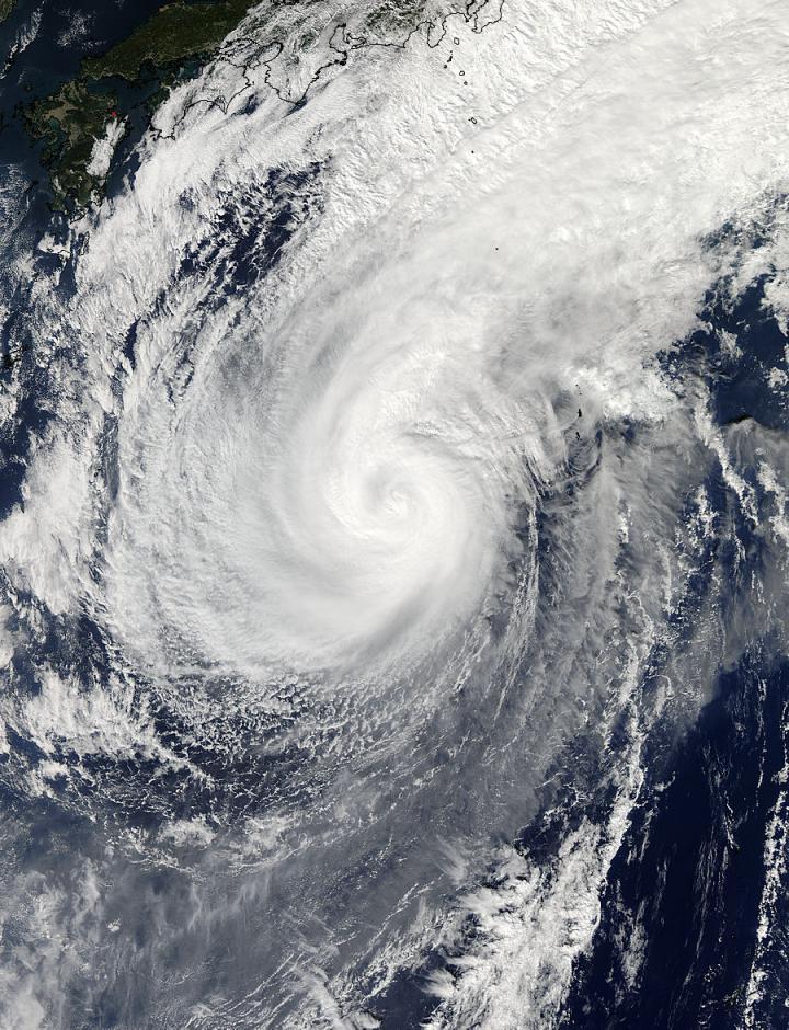
NASA's Aqua satellite captured a visible picture of Typhoon Nuri on Nov. 5 at 4:10 UTC (11:10 p.m. EST, Nov. 4).
(Photo Credit: Image : NASA Goddard MODIS Rapid Response Team)
By 1500 UTC (10 a.m. EST) on Nov. 5, Nuri's maximum sustained winds had dropped to 80 knots (92 mph/148.2 kph) as a result of increased wind shear. Nuri was centered near 27.2 north latitude and 139.2 east longitude. That's about 174 nautical miles (200 miles/322 km) northwest of Iwo To. Nuri was moving to the northeast at 10 knots (11.5 mph/18.5 kph).
Nuri is expected to continue weakening as it moves in a northeasterly direction, while remaining over open waters in the western North Pacific. Forecasters at the Joint Typhoon Warning Center also expect Nuri to begin transitioning into an extra-tropical storm over the next day or two.
Source: NASA/Goddard Space Flight Center