Tropical Storm Flossie is expected to bring a lot of moisture to the leeward side of the Hawaiian Islands where the Kona coffee crops are located. That moisture will then be pushed up the mountainous terrain (orographic lift), which will go over the mountainous areas and rain on the windward side.
Flossie will be moving in the big island during the morning (local time) today, July 29.
Satellite data shows that the center of circulation is south of the strongest thunderstorms with the coldest cloud tops. Cloud top temperatures are seen on infrared imagery from the Atmospheric Infrared Sounder or AIRS instrument that also flies aboard NASA's Aqua satellite.
At 8 a.m. EDT /2 a.m. HST the Central Pacific Hurricane Center or CPHC in Honolulu, Hawaii noted that the center of Tropical Storm Flossie was located near latitude 19.6 north and longitude 152.5 west, just 165 miles (320 km) east of Hilo, Hawaii. Flossie is moving toward the west near 16 mph (28 kph) and is expected to continue for next 12 hours with a slight turn to the west northwest after that. Flossie's maximum sustained winds were near 50 mph (85 kph) and some weakening is forecast during the next 48 hours. According to CPHC, tropical storm force winds extend outward up to 100 miles (160 km) from the center.
Tropical storm conditions are expected over the big Island and Maui County today and Oahu tonight. Tropical storm conditions are possible on Kauai and Niihau tonight. Dry air aloft and northerly wind shear are expected to weaken Flossie further in the next day or two as it moves through the Hawaiian Islands.
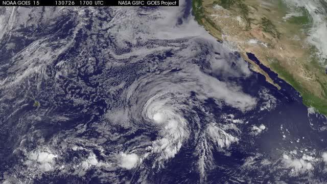
This NOAA GOES-West satellite animation from July 26 to July 39 shows the movement of Tropical Storm Flossie from the Eastern Pacific into the Central Pacific Ocean and approaching Hawaii. TRT 0:36
(Photo Credit: Courtesy: NASA/NOAA GOES ProjectCenter Contact: Rob Gutro (301) 286-4044HQ Contact: J.D.Harrington (202) 358-5241)
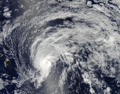
The MODIS instrument that flies aboard NASA's Aqua satellite captured this image of Tropical Storm Flossie on July 28 at 23:10 UTC (7:10 p.m. EDT) as it continued moving toward Hawaii (left).
(Photo Credit: NASA Goddard MODIS Rapid Response Team)
Source: NASA/Goddard Space Flight Center