Tropical Cyclone Bakung is moving in a westerly direction over the open waters of the Southern Indian Ocean and NASA's Aqua satellite captured an image of the sea storm.
Aqua passed over Bakung on Dec. 12 at 07:35 UTC (2:35 a.m. EST) and the MODIS instrument aboard took a visible image of the storm. The image showed that deeper convection (stronger currents of rising air that form the thunderstorms that make up the tropical cyclone) was occurring around the low-level center of circulation, so the center was not apparent in the MODIS imagery. The bulk of the clouds associated with Bakung, however, were over the southeasterly quadrant as a result of low to moderate northwesterly vertical wind shear.

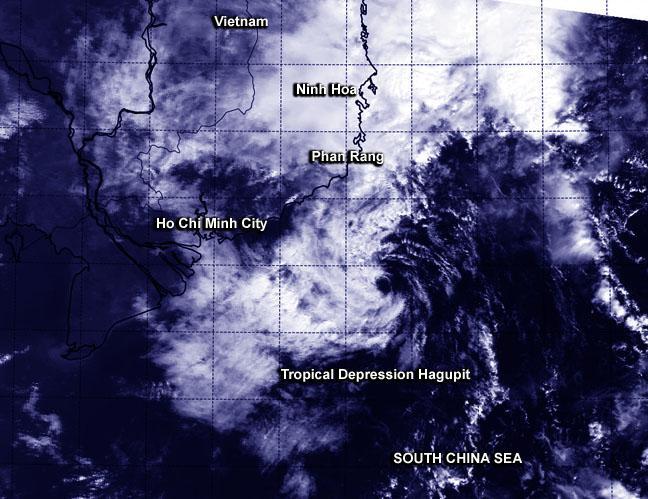
NASA's Terra satellite took a visible picture of Hagupit on Dec. 11 at 10 p.m. EST winding down southeast of Vietnam's southern coast.
(Photo Credit: NASA/NRL)
By 1500 UTC (10 a.m. EST), Bakung was located near 9.7 north longitude and 92.4 east latitude, nor 1,214 nautical miles (1,397 miles/2,248 km) east of Diego Garcia. Diego Garcia is a coral atoll located in the south central Indian Ocean. It is part of the British Indian Ocean Territory/
Bakung was moving to the west-southwest at 6 knots (6.9 mph/11.1 kph) and is expected to continue in that general direction over the next several days. Bakung's maximum sustained winds were near 40 knots (46 mph/74 kph). The cyclone is expected to slowly intensify over the next couple of days, nearing hurricane-force by Dec. 16 while remaining over open ocean.
Source: NASA/Goddard Space Flight Center