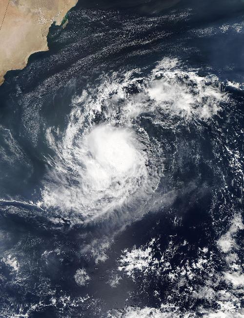
Yemen's Socotra Island just endured Cyclone Chapala and just a week later is facing a second tropical cyclone: Megh. NASA's Aqua satellite passed over Megh and captured data on the strengthening storm on Nov., 6.
When Aqua flew over Megh from space, the Moderate Resolution Imaging Spectroradiometer or MODIS instrument aboard took a visible picture of the storm. The MODIS image showed fragmented bands of thunderstorms wrapping into the low-level center, which was obscured by clouds.
At 1500 UTC (10 a.m. EST) on Friday, Nov. 6, 2015, Tropical Cyclone Megh, formerly known as Tropical Cyclone 05A had maximum sustained winds near 45 knots (51.7 mph/83.3 kph). Megh was a tropical storm and continued to strengthen. It was centered near 12.9 degrees north latitude and 60.8 east longitude, about 368 nautical miles (423.5 miles/681.5 km) east of Socotra Island, Yemen. It was moving to the west at 10 knots (11.5 mph/18.5 kph).
 When Aqua flew over Megh on Nov. 6 at 09:15 UTC (4:15 a.m. EDT) it saw fragmented bands of thunderstorms wrapping into the low-level center, which was obscured by clouds. Credit: Credits: NASA Goddard MODIS Rapid Response Team
Forecasters at the Joint Typhoon Warning Center (JTWC) expect Megh to continue to move west-southwest in the Arabian Sea and pass just south of Socotra Island, Yemen, on Nov. 8 on its way toward the Horn of Africa.
JTWC expects Megh to intensify to hurricane-strength, up to 75 knots before passing near Socotra Island. Megh is then expected to pass over the tip of Cape Gardafui, Somalia and curve over the Gulf of Aden where it will encounter cooler waters and increasing vertical wind shear which are expected to weaken it.
JTWC expects Megh will make landfall near Aden, Yemen on Nov. 11.
source: NASA/Goddard Space Flight Center