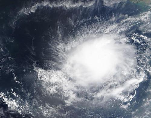
Tropical Cyclone 03A formed in the Arabian Sea, Northern Indian Ocean on October 10 and by October 12 it weakened to a remnant low pressure area. NASA's Terra satellite happened over the storm when it developed and caught a visible image of this short-lived storm.
The Moderate Resolution Imaging Spectroradiometer or MODIS instrument that flies aboard NASA's Terra satellite passed over Tropical Cyclone 03A as it was forming on Oct. 10, 2015 at 06:30 UTC (2:30 a.m. EDT). The MODIS image showed a concentration of storms around the center of circulation.
On October 10 at 9:40 p.m. Tropical cyclone 03A formed near 15.6 North latitude and 69.5 East longitude, about 570 miles south-southeast Karachi, Pakistan. 03A was moving to the north-northeast at 3 knots (3.4 mph/5.5 kph). Maximum sustained winds were near 30 knots (35 mph/55 kph). 03A was moving very slowly for the next few days.
 On Oct. 10, 2015 at 06:30 UTC (2:30 a.m. EDT) NASA's Terra satellite saw Tropical Storm Three (03A) in the Arabian Sea. Credit: Credits: NASA Goddard MODIS Rapid Response Team
Tropical Cyclone 03A fizzled on October 11 over open waters of the Arabian Sea. At 0900 UTC (5 a.m. EDT) the Joint Typhoon Warning Center issued the final bulletin on the system when it was located near 16.0 North and 69.3 East. That's about 551 nautical miles south-southeast of Karachi, Pakistan. It was moving to the northwest at 2 knots (2.3 mph/3.7 kph) and was weakening.
By October 13, 2015 the storm became a remnant low pressure area.
source: NASA/Goddard Space Flight Center