The NHC discussion on May 9 noted that the upper-level winds have become unfavorable for development and this system, so System 90E now has a very low chance, near 0 percent of becoming a tropical cyclone during the next 48 hours or over the next five days for that matter- which is good news for southwestern Mexico.
Despite not having the potential to develop, however, System 90E is expected to continue to produce locally heavy rainfall and gusty winds over portions of southwestern Mexico during the next day or so, according to NHC. The Mexican Weather Service noted that System 90E has the potential to bring torrential rainfall to Michoacán and Guerrero states totaling between 5.9 to 9.8 inches (150 to 250 mm). These rains could produce life-threatening flash floods and mud slides.

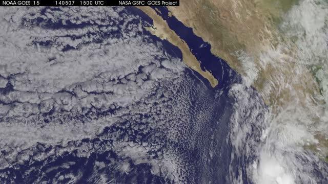
This movie of imagery from NOAA's GOES-West satellite from May 7 at 14:15 UTC to May 9 at 14:15 UTC shows System 90E's progression and movement on land in southwestern Mexico (it moves east out of the frame on May 9).
(Photo Credit: Image : NASA/NOAA GOES Project)

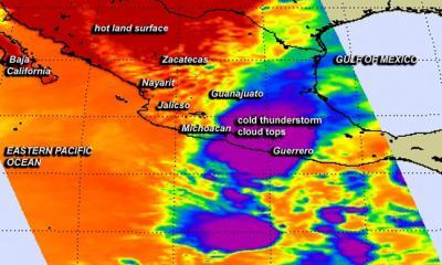
This false-colored infrared image from NASA's AIRS instrument shows the high, cold cloud tops (purple) associated with the thunderstorms in System 91B as it moves over southern Mexico on May 8 at 20:11 UTC/4:11 p.m. EDT.
(Photo Credit: Image : NASA JPL, Ed Olsen)
Source: NASA/Goddard Space Flight Center