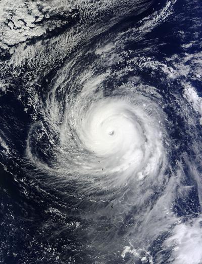
Super-typhoon Lekima is poised to "make the curve" in the northwestern Pacific Ocean today. The storm's track is expected to shift from a northwesterly direction, and curve to northeasterly direction because it has started encountering mid-latitude westerly winds and a trough. NASA's Terra satellite captured an image of Lekima just before it began its directional shift.
The Moderate Resolution Imaging Spectroradiometer or MODIS instrument aboard NASA's Terra satellite captured a visible image of Super-typhoon Lekima in the Northwestern Pacific Ocean on Oct. 24 at 0105 UTC/Oct. 23 at 9:05 p.m. EDT as it ran into an elongated area of low pressure from the west, as well as mid-latitude westerlies and wind shear. Those factors started to elongate the system and change the storm's direction. The MODIS image showed a well- defined eye, about 25 nautical miles/28.7 miles/46.3 km wide and a thick eyewall of powerful thunderstorms around it.
On Oct. 24 at 11 a.m. EDT/1500 UTC, Super-typhoon Lekima's maximum sustained winds were near 130 knots/149 mph/240.8 kph. It was centered near 23.2 north and 145.4 east, about 274 nautical miles/315 miles/ 507 km east-southeast of Iwo To. Lekima was still traveling to the northwest at 14 knots/16.1 mph/25.9 kph toward the Japanese Island of Iwo To, but it is expected to curve and head toward the northeast in the next day.

NASA's Terra satellite image on Oct. 23 at 00:25 clearly showed Lekima's 20 nautical mile/23 mile/37 km-wide-eye with bands of thunderstorms wrapping tightly into the center of circulation.
(Photo Credit: NASA Goddard MODIS Rapid Response Team)
Lekima is a powerful storm and is generating very rough seas. Wave heights are near 45 feet/13.7 meters, and those waves are propagating toward Iwo To.
Forecasters at the Joint Typhoon Warning Center noted that as Lekima moves northeast it will get embedded in the mid-latitude westerly winds. Cooler sea surface temperatures and increasing wind shear will weaken the storm, and it will become extra-tropical in a couple of days.
Source: NASA/Goddard Space Flight Center