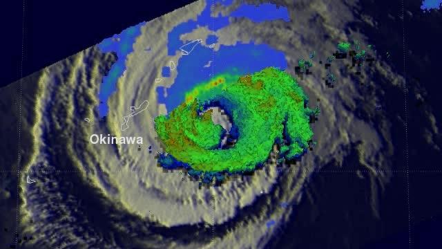
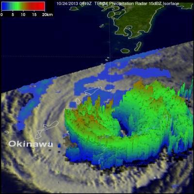
Radar reflectivity data from TRMM's PR instrument were used to create 3-D images that showed differences between super typhoon Lekima and tropical storm Francisco. TRMM is managed by both NASA and the Japan Aerospace Exploration Agency.
On Oct. 24 at 1500 UTC/11 a.m. EDT, Francisco's maximum sustained winds were near 60 knots/69 mph/111 kph. Francisco was centered near 26.9 north and 130.8 east, about 134 nautical miles east of Kadena Air Base, Okinawa, Japan. Francisco was moving to the northeast at 7 knots/8 mph/12.9 kph and away from the island.
Francisco is being pushed to the northeast by mid-latitude westerly winds, which are also affect Super-typhoon Lekima behind it. The tropical storm appears elongated on satellite imagery today showing the effect that the westerlies are having on it. Francisco is expected to continue on a northeast track paralleling eastern Japan, but staying out to sea.

This is a TRMM 3-D flyby animation over tropical storm Francisco on Oct. 24 that shows cloud heights and rainfall.
(Photo Credit: NASA/SSAI, Hal Pierce)

This 3-D image of Tropical Storm Francisco on Oct. 24, 2013 shows the heaviest rainfall rates and highest clouds in red.
(Photo Credit: NASA/SSAI, Hal Pierce)
Source: NASA/Goddard Space Flight Center