Hurricane Season ends on November 30, and subtropical storm Melissa formed with less than two weeks to go. Melissa formed on Monday, November 18 about 695 miles/1,120 km east-southeast of Bermuda, near 29.3 north and 53.6 west. It had maximum sustained winds near 50 mph/85 kph and was moving to the northwest at 9 mph/15 kph.
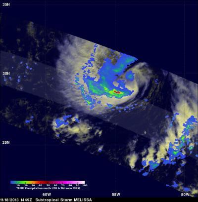
NASA's TRMM satellite flew above subtropical storm Melissa as it formed in the central Atlantic Ocean on November 18, 2013 at 1449 UTC (9:49 a.m. EST). TRMM captured rainfall data on Melissa using TRMM's Microwave Imager (TMI) and Precipitation Radar (PR). Both data were overlaid on an enhanced visible/infrared image from TRMM's Visible and InfraRed Scanner (VIRS). The TRMM pass found that the heaviest rainfall within Melissa was falling at a rate of over 74mm~2.9 inches per hour in an area of strong convective rainfall that was wrapping around the southern side of the storm.

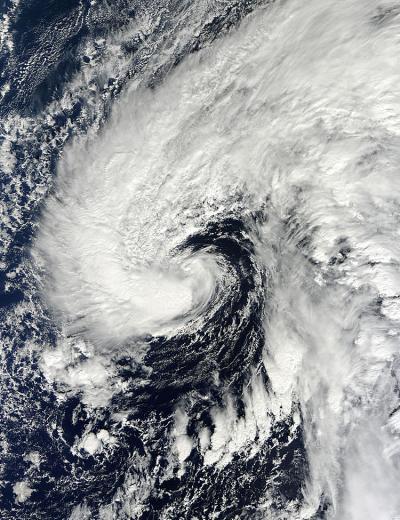
The MODIS instrument aboard the Terra satellite captured this image of Melissa as she formed on Monday, Nov. 18 about 695 miles/1,120 km east-southeast of Bermuda.
(Photo Credit: Image : NASA Goddard MODIS Rapid Response Team)
On Nov. 19 at 10 a.m. EST, Melissa was moving north over the central Atlantic Ocean and the National Hurricane Center expects it to transition into a tropical storm later in the day. At 1500 UTC/10 a.m. EST, Melissa's maximum sustained winds were near 65 mph/100 kph. It was moving to the north at 10 mph/17 kph. Melissa's center was located about 595 miles/960 km east of Bermuda, near 31.9 north and 54.6 west.
The National Hurricane Center reported that various satellite data indicate that Melissa appears to be separating from the elongated parent cloud band east of the circulation center suggesting that the storm may be transitioning into a tropical cyclone.
Although Melissa is not a threat to land, the subtropical storm is causing rough surf and large swells to affect Bermuda, parts of the northern Leeward Islands, Puerto Rico, Hispaniola and southeastern Bahamas. Those conditions are expected to continue over the next couple of days and include life-threatening surf and rip currents.
Melissa is expected to the move to the north-northeast over the open waters of the North Atlantic Ocean and become a tropical storm later on Nov. 19.

On Nov. 18, 2013, NASA's TRMM satellite found that the heaviest rainfall within Melissa was falling at a rate of over 74mm~2.9 inches per hour in an area of strong convective rainfall that was wrapping around the southern side of the storm.
(Photo Credit: Image : NASA/SSAI/Hal Pierce)

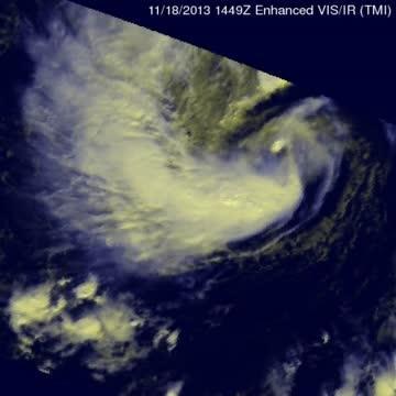
This Nov. 18 animation of Subtropical storm Melissa shows the TMI/PR instruments rain blending with NASA's TRMM satellite's VIRS instrument.
(Photo Credit: Image : NASA/SSAI/Hal Pierce)
Source: NASA/Goddard Space Flight Center