On Oct.31 at 0255 UTC, the Moderate Resolution Imaging Spectroradiometer instrument known as MODIS that flies aboard NASA"s Terra satellite captured a picture of Tropical Storm Krosa. The MODIS image showed Krosa's western edge over Luzon in the northern Philippines
At 1500 UTC/11 a.m. EDT, Krosa's center was over land in extreme northern Luzon, and headed for the South China Sea. At that time, Krosa's maximum sustained winds were near 90 knots/103.6 mph/ 166.7 kph. The center of Krosa was located near 18.4 north and 121.2 east, about 227 nautical miles/261 miles/420 km north-northeast of Manila, Philippines. It was headed to the west-northwest at 12 knots/13.8 mph/22.22 kph.
Satellite imagery on Oct. 31 showed that Krosa had an eye 25 nautical miles/28.7 km/46.3 km in diameter at landfall in northern Luzon.
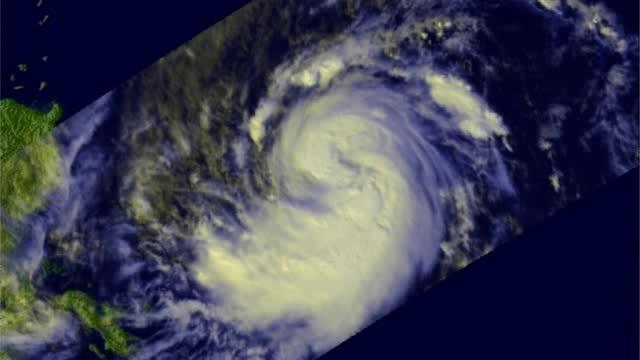
In this flyby animation of Oct. 30, NASA's TRMM satellite found precipitation falling at a rate of about 81mm/~3.2 inches per hour in strong convective storms near Krosa's center.
(Photo Credit: NASA/SSAI, Hal Pierce)
Krosa is expected to re-intensify in the South China Sea and affect Hainan Island, China before making a final landfall in northern Vietnam.
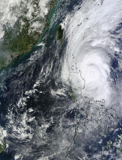
On Oct.31 at 0255 UTC, NASA's Terra satellite captured this picture of Tropical Storm Krosa's western edge over Luzon in the northern Philippines.
(Photo Credit: NASA Goddard MODIS Rapid Response Team)
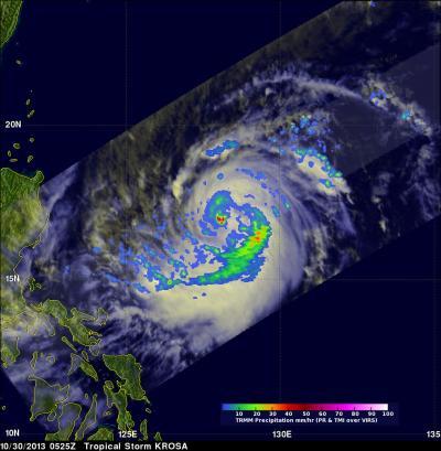
On Oct. 30, NASA's TRMM satellite found precipitation falling at a rate of about 81mm/~3.2 inches per hour in strong convective storms near Krosa's center.
(Photo Credit: NASA/SSAI, Hal Pierce)
Source: NASA/Goddard Space Flight Center