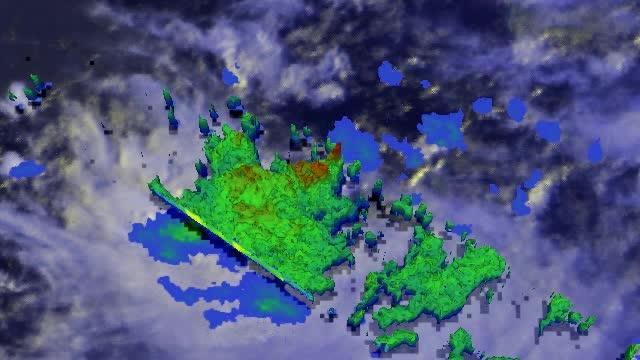
At NASA's Goddard Space Flight Center in Greenbelt, Maryland, TRMM PR data were used to create a 3-D image that showed a simulated view of the tropical disturbance's rainfall structure. In the 3-D image, tall storms were shown reaching heights of over 14km (about 8.7 miles) and returning reflectivity values of over 52dBZ to the satellite.
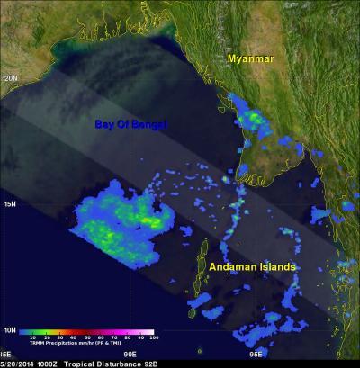
TRMM had another fairly good look at 92B on May 20 at 1000 UTC (6:00 a.m. EDT). TRMM's Microwave Imager (TMI) had a better view than the PR instrument that flew over the northern edge of 92B. TMI showed that 92B was better organized than previously and estimated that rain was falling at a rate of over 33.8 mm (1.3 inches) per hour in some areas.
The Joint Typhoon Warning Center or JTWC noted that a microwave image from Europe's METOP-B satellite on May 21 at 04:54 UTC (12:54 a.m. EDT) showed that the bulk of strong thunderstorms and deep convection in System 92B was over the storm's southern quadrant and wrapping into the low-level center.

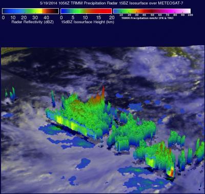
In this TRMM 3-D simulated flyby of System 92B from May 19, tall storms were shown reaching heights of over 14km (about 8.7 miles).
(Photo Credit: NASA/SSAI, Hal Pierce)
On May 21 at 07:30 UTC/3:30 a.m. EDT the JTWC gave System 92B a high chance for development. At that time the center of circulation was near 16.1 north latitude and 91.4 east longitude, about 375 nautical miles south of Chittagong, Bangladesh.
Another instrument on METOP-B looked at the developing storm's winds. The prime objective of Advanced SCATterometer (ASCAT) is to measure wind speed and direction over the oceans. An image from ASCAT on May 21 at 03:57 UTC showed that the circulation of 92B appeared elongated, with 35 to 40 knot winds over the southwestern quadrant and weaker winds (15 to 20 knots) over the northern semi-cicle.
JTWC noted that the warm sea surface temperatures in the area will help with development.

In this TRMM 3-D image of System 92B from May 20, rain was falling at a rate of over 33.8 mm (1.3 inches) per hour in some (red) areas.
(Photo Credit: NASA/SSAI, Hal Pierce)

On May 19, 2014, at 1056 UTC NASA's TRMM satellite flew over System 92B in the Bay Of Bengal and found that rain was falling at a rate of over 138 mm (about 5.4 inches) per hour. TRMM data was overlaid on a METEOSAT-7 visible/infrared image.
(Photo Credit: NASA/SSAI, Hal Pierce)
Source: NASA/Goddard Space Flight Center