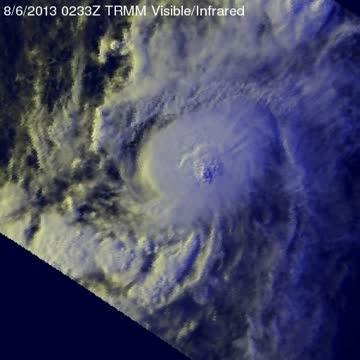
At 11 a.m. EDT on Aug. 7, Hurricane Henriette's maximum sustained winds were near 85 mph/140 kph, and little change in strength is expected today, while weakening is expected to begin tomorrow, Aug. 8. The center of Hurricane Henriette was located near latitude 16.2 north and longitude 134.9 west, about 1,350 miles/2,170 km east of Hilo, Hawaii. Henriette is moving toward the west-northwest near 10 mph/17 kph and is expected to continue in that direction before turning west tomorrow, Aug. 8.
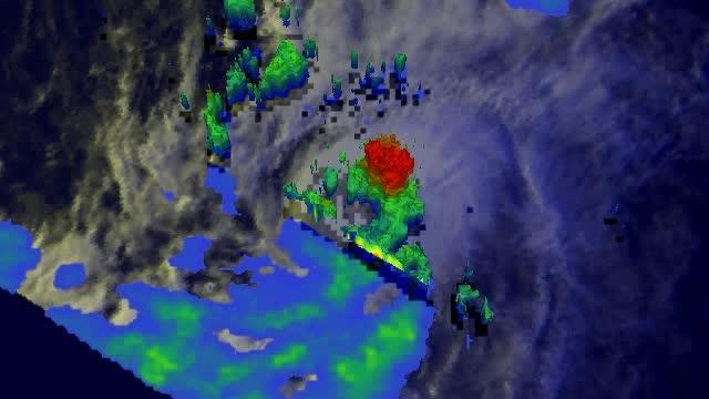
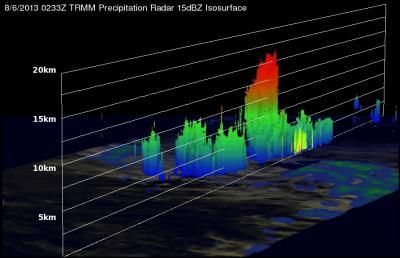
This 3-D image (looking toward the east) from TRMM PR data reveals that towering storms in the northeastern side of Henriette's eye were reaching height of almost 16.75km (~10.41 miles).

This 3-D image (looking toward the east) from TRMM PR data reveals that towering storms in the northeastern side of Henriette's eye were reaching height of almost 16.75km (~10.41 miles).
(Photo Credit: SSAI/NASA, Hal Pierce)

TRMM is able to measure rainfall occurring in a storm from its orbit in space. TRMM's measured rain falling at the rate of over 55.46 mm (~2.2 inches) per hour a towering thunderstorm near Henriette's center.
(Photo Credit: SSAI/NASA, Hal Pierce)

TRMM is able to measure rainfall occurring in a storm from space. Rainfall is derived from TRMM's Microwave Imager and Precipitation Radar instruments. TRMM's PR instrument measured rain falling at the rate of over 55.46 mm (~2.2 inches) per hour a towering thunderstorm near Henriette's center.
(Photo Credit: SSAI/NASA, Hal Pierce)
Source: NASA/Goddard Space Flight Center