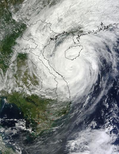
On Nov. 10 at 03:30 UTC/Nov. 9 at 10:30 p.m. EDT, the Moderate Resolution Imaging Spectroradiometer or MODIS instrument aboard NASA's Terra satellite showed the center of Typhoon Haiyan was just south of Hainan Island, China in the South China Sea. Later in the day, Haiyan moved north of Hainan Island and headed for a landfall in extreme northeastern Vietnam. Haiyan's maximum sustained winds were near 75 knots/86 mph/138.9 kph. At 1500 UTC/10 a.m. EDT on Nov. 10. At that time it was centered near 19.8 north and 107.9 east, about 160 nautical miles southeast of Hanoi, Vietnam, and moving to the north-northwest at 17 knots/19/5 mph/31.48 kph.
According to RT news.com more than 174,000 households were evacuated, which is about 600,000 people. Haiyan was forecast to make landfall on Nov. 11 at 0000 UTC/8 a.m. Nov 8 local time/(7 p.m. EST Nov. 10), near the Cam Pha District, which is over 100 miles east of Hanoi. Early on Nov. 11, Haiyan made landfall in extreme northeastern Vietnam, as predicted.
On Nov. 11 at 0300 UTC/10 a.m. Vietnam local time/Nov. 10 at 9 p.m. EDT Haiyan was moving over land and its maximum sustained winds were still near 60 knots/69 mph/111.1 kph. The center of the tropical storm was located near 22.2 north and 107.4 east, just 87 nautical miles northeast of Hanoi, Vietnam. Haiyan was moving to the north at 13 knots/14.9 mph/24.0 kph.

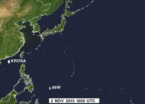
This TRMM animation of flood potential from Nov. 2 to Nov. 12 shows the movement of Tropical Storm 30W, Typhoon Krosa and Super-Typhoon Hainan. Yellow is low, orange is medium, and red is high.
(Photo Credit: Image : NASA SSAI/Hal Pierce)
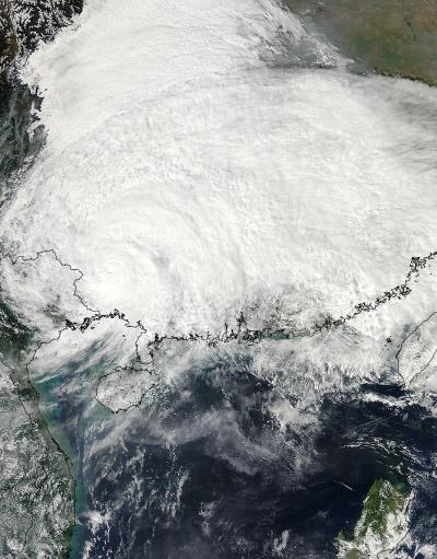
Animated enhanced infrared satellite imagery showed the storm was weakening quickly while over land and that bulk of the thunderstorms (and convection) had been pushed north of the center as a result of increasing winds shear from the southwest. On Nov. 11 at 05:45 UTC, the Moderate Resolution Imaging Spectroradiometer or MODIS instrument aboard NASA's Aqua satellite captured an image of Tropical Storm Haiyan over mainland China. The MODIS image showed the extent of cloud cover from northeastern Vietnam over the Guangxi, Guangdong, Hunan, Guizhou, Sichuan, Chongqing, Hubei, Shaanxi, Henan, Anhui and Jaingxi provinces.
Mid-latitude westerly winds moving over China helped weaken the storm. Haiyan is forecast to turn to the east and dissipate in the next day.

On Nov. 11 at 05:45 UTC, the MODIS instrument aboard NASA's Aqua satellite captured this image of Tropical Storm Haiyan over mainland China.
(Photo Credit: Image : NASA Goddard MODIS Rapid Response Team)

On Nov. 10 at 03:30 UTC/Nov. 9 at 10:30 p.m. EDT, the MODIS instrument aboard NASA's Terra satellite showed the center of Typhoon Haiyan just south of Hainan Island, China in the South China Sea.
(Photo Credit: Image : NASA Goddard MODIS Rapid Response Team)
Source: NASA/Goddard Space Flight Center