Tropical Storm Sinlaku made landfall in east-central Vietnam bringing some moderate to heavy rainfall with it. NASA and the Japan Aerospace Exploration Agency's TRMM and GPM satellites analyzed the rainfall rates occurring in Sinlaku before it made landfall while NASA's Terra satellite spotted the storm as it came ashore in Vietnam.
Tropical Storm Sinlaku formed on November 26, 2014 over the southeastern Philippines. As a tropical depression Sinlaku caused flooding in areas of the Visayas and Mindanao. The storm then moved west and crossed the South China Sea where it headed to Vietnam for a final landfall.
The Tropical Rainfall Measuring Mission or TRMM satellite and the Global Precipitation Measurement or GPM core satellites viewed Sinlaku after it had strengthened into a tropical storm over the South China Sea.
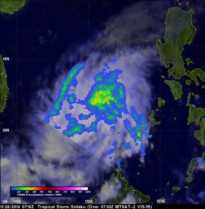
The TRMM satellite flew over Sinlaku on Nov. 28, 2014 at 0716 UTC and measured moderate rainfall.
(Photo Credit: SSAI/NASA/JAXA, Hal Pierce)
Both TRMM and GPM provided information about the rate in which rain was falling within the storm. Rainfall derived from TRMM Microwave Imager (TMI) data was collected when the satellite flew over on November 28, 2014 at 0716 UTC (2:16 a.m. EST). The GPM Microwave Imager (GMI) measurements occurred a little over six hours later at 1326 UTC (8:26 a.m. EST). The GMI found rain falling at a rate of over 82 mm/3.2 inches per hour in powerful thunderstorms north of Sinlaku's center of circulation.
At NASA's Goddard Space Flight Center in Greenbelt, Maryland, a 3-D view of Sinlaku's precipitation structure was made using data from the Ku band on GPM's dual frequency radar instrument (DPR). DPR showed that some thunderstorms were reaching heights of 16.41 km (about 10.2 miles). The energy released by these towering storms often signals intensification in tropical cyclones. The Joint Typhoon Warning Center (JTWC)predicted that Sinlaku would intensify and reach close to typhoon force winds of 60 knots (69 mph) before hitting Vietnam on November 30, 2014.
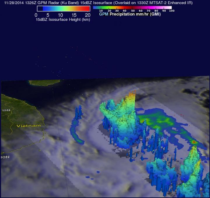
On Nov. 28, the GPM satellite saw rain falling at a rate of over 82 mm/3.2 inches per hour north of Sinlaku's center of circulation where thunderstorms were as high as 16.41 km (10.2 miles).
(Photo Credit: SSAI/NASA/JAXA, Hal Pierce)
On Nov. 29 at 03:30 UTC (Nov. 28 at 10:30 p.m. EST), the MODIS (Moderate Resolution Imaging Spectroradiometer) instrument aboard NASA's Terra satellite took a visible image of Tropical Storm Sinlaku as it began making landfall in Vietnam. At that time the western quadrant of the storm was over the coast near Phu Yen.
Sinlaku made landfall in the Phu Yen Province and affected a large area from the Quang Ngai to Khanh Hoa Provinces. The storm moved inland and weakened into a depression on Nov. 30.
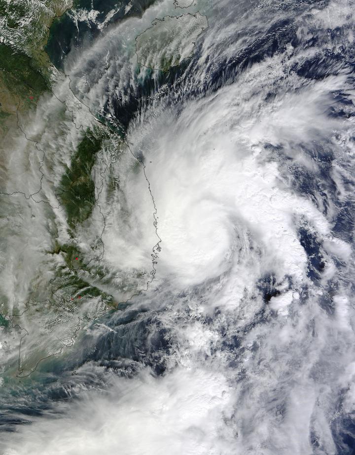
On Nov. 29 at 03:30 UTC, the MODIS instrument aboard NASA's Terra satellite took this visible image of Tropical Storm Sinlaku making landfall in Vietnam.
(Photo Credit: NASA Goddard MODIS Rapid Response)
Source: NASA/Goddard Space Flight Center