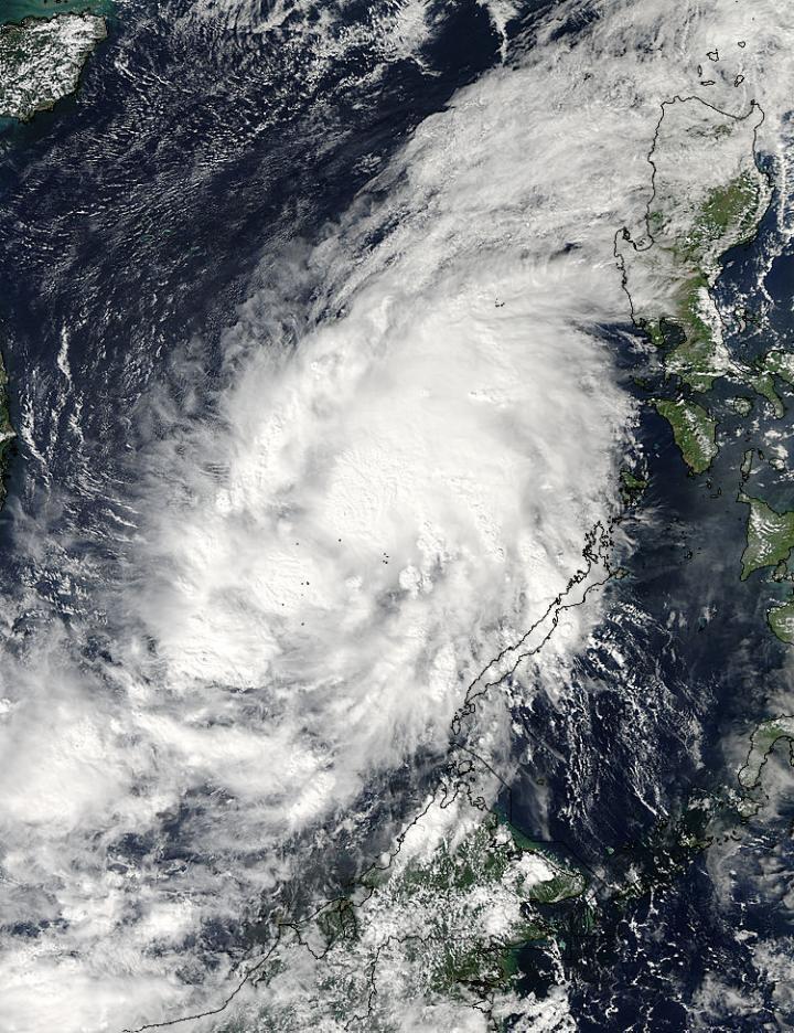
Tropical Depression 21W crossed the Philippines and moved into the South China Sea where warm waters helped strengthen the storm into Tropical Storm Sinlaku. NASA's Aqua satellite passed over the storm and captured an image that showed it appeared elongated.
Despite the strengthening of Tropical Depression 21W into a tropical storm on Nov. 28, it appeared elongated from southwest to northeast on visible imagery taken by the Moderate Resolution Imaging Spectroradiometer (MODIS) instrument that flies aboard Aqua. The MODIS image also showed that the strongest thunderstorms appeared northeast of center.
On Friday, Nov. 28 at 1500 UTC (10 a.m. EST) Sinlaku's maximum sustained winds had increased to 45 knots. Forecasters at the Joint Typhoon Warning Center (JTWC) expect the storm's winds to peak near 60 knots (69.0 mph/111.1 kph) on Nov. 29 before weakening. Sinlaku was centered near 12.0 north longitude and 106.4 east latitude, about 457 nautical miles (526 miles/846.4 km) east of Ho Chi Minh City, located in extreme southern Vietnam. The storm was moving to the west-northwest at 15 knots (17.2 mph/27.7 kph) and is expected to continue in that general direction.

The MODIS instrument aboard NASA's Aqua satellite captured this visible image of Tropical Storm Sinlaku in the South China Sea on Nov. 28 at 5:50 UTC (12:50 a.m. EST).
(Photo Credit: NASA Goddard MODIS Rapid Response Team)
The Vietnam Meteorological Agency issued a Tropical Storm Warning for several areas of the country. For updated warnings, visit: http://www.nchmf.gov.vn/web/en-US/43/Default.aspx.
The current forecast track takes Sinlaku's landfall just north of Quang Ngai on Nov. 29. Quang Ngai is located in east-central Vietnam. The storm is expected to dissipate rapidly after making landfall.
Source: NASA/Goddard Space Flight Center