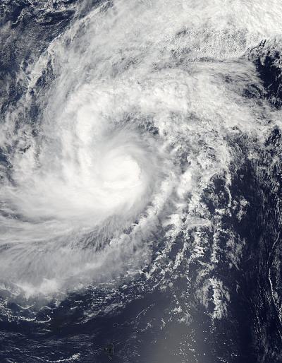
NASA's Aqua satellite captured an image of the tropical cyclone called Faxai as it reached typhoon strength in the Northwestern Pacific Ocean today, March 4.
On March 4 at 1500 UTC/10 a.m. EST, Tropical cyclone Faxai reached typhoon strength with maximum sustained winds near 65 knots/74.8 mph/120.4 kph. It was centered near 18.2 north and 151.6 east, about 429 nautical miles east-northeast of Andersen Air Force Base, Guam. Faxai was moving to the north-northeast at 16 knots/18.4 mph/29.6 kph.
On March 4 at 03:05 UTC, the Moderate Resolution Imaging Spectroradiometer or MODIS instrument aboard NASA's Aqua satellite captured an image of Typhoon Faxai in the North Pacific Ocean. The MODIS image showed tightly wrapped bands of thunderstorms around the center of circulation.

The MODIS instrument aboard NASA's Aqua satellite captured this image of Typhoon Faxai in the North Pacific Ocean on March 4 at 03:05 UTC.
(Photo Credit: NASA Goddard MODIS Rapid Response Team)
Forecasters at the Joint Typhoon Warning Center or JTWC noted that animated infrared satellite imagery revealed an 8 nautical-mile-wide (9.2 mile/14.8 km) eye feature has developed while the system has become more compact and symmetric. Thunderstorms around the edge of the system, however, appeared to be weakening.
The JTWC expects Faxai to maintain typhoon strength for a day before weakening.
Source: NASA/Goddard Space Flight Center