One hour before midnight Eastern Daylight Time on Sept. 4, Tropical Depression 7 strengthened into Tropical Storm Gabrielle just 70 miles south of Ponce, Puerto Rico. NOAA's GOES-East satellite captured the development and NASA's GOES Project created an animation that showed the developing storm.
Tropical Depression Seven had formed at 5 p.m. EDT on Sept. 4 and just 6 hours later it organized and strengthened into Gabrielle. Tropical Storm Gabrielle was bringing heavy rains to Puerto Rico and adjacent islands during the morning of Sept. 5. NOAA's GOES-East satellite captured an image of Gabrielle at 7:32 a.m. EDT today, Sept. 5 that showed Gabrielle over Puerto Rico. NASA's GOES Project, located at the NASA Goddard Space Flight Center in Greenbelt, Md. compiled five days of images from Sept. 1 to Sept. 5 and created a seven second animation that shows the development of Gabrielle from the beginning.
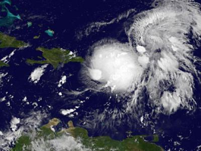
NOAA's GOES-East satellite captured an image of Gabrielle at 7:32 a.m. EDT today, Sept. 5 that showed Gabrielle over Puerto Rico, at 5 a.m. EDT Gabrielle had maximum sustained winds near 40 mph.
(Photo Credit: Image : NASA GOES Project)
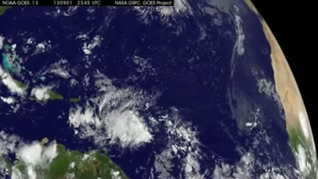
This GOES-East series of animations from Sept. 1 through Sept. 5 shows the development of Tropical Depression 7 into Tropical Storm Gabrielle near Puerto Rico (lower right).
(Photo Credit: Image : NASA GOES Project)
Source: NASA/Goddard Space Flight Center