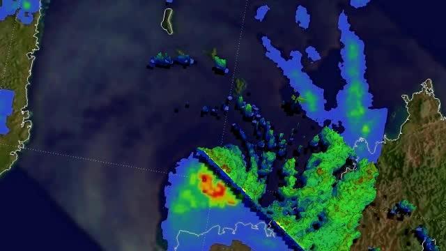
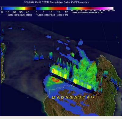
TRMM PR data were collected at the same time in a swath that passed near the northern edge of tropical cyclone Hellen's eye wall. Those data were used to create a simulated 3-D view of Hellen's precipitation and also revealed that some powerful storms in Hellen's eye wall were reaching heights of over 13 km/8 miles.
Hellen seemed to run out of steam over Madagascar and the Joint Typhoon Warning Center issued the final warning on the tropical low pressure area on April 1 at 0300 UTC/March 31 at 11 p.m. EDT. AT that time, Hellen was centered near 17.0 south latitude and 46.1 east longitude, about 130 nautical miles/~150 miles/~241 km north-northwest of Antananarivo, Madagascar. Hellen was trudging to the south-southeast at 5 knots/5.7 mph/9.2 kph as it continued weakening.
Thirty minutes after the last warning from the JTWC, Hellen's remnants had moved back over water in the Mozambique Channel. The JTWC noted that because of favorable conditions such as warm water and low wind shear, the storm could regenerate in the next couple of days.

This 3-D simulated flyby of Tropical Cyclone Hellen on March 30, showed some powerful storms in Hellen's eye wall were reaching heights of over 13 km/8 miles.
(Photo Credit: : SSAI/NASA, Hal Pierce)

On March 30, the TRMM satellite showed some powerful storms in Hellen's eye wall were reaching heights of over 13 km/8 miles.
(Photo Credit: Image : SSAI/NASA, Hal Pierce)
Source: NASA/Goddard Space Flight Center