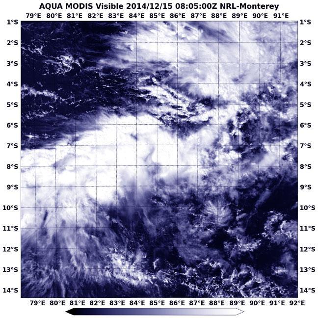
Tropical Cyclone Bakung ran into adverse conditions in the Southern Indian Ocean that weakened it to a remnant low pressure system when NASA's Aqua satellite spotted it on Dec. 15.
The Moderate Resolution Imaging Spectroradiometer or MODIS instrument that flies aboard Aqua captured a visible picture of Bakung's elongated remnants on Dec. 5 at 08:05 UTC (3:05 a.m. EST). The storm appeared to be stretched out from west to east in the visible image.
The last advisory on the tropical cyclone came on Dec. 13 when the storm was still a tropical storm with maximum sustained winds near 35 knots (40 mph/62 kph), but weakening. Bakung was located near 9.1 south longitude and 89.6 east latitude or about 466 nautical miles (536 miles/863 km) west-northwest of Cocos Islands. It was still moving to the west-northwest at 8 knots (9.2 mph/14.8 kph).

NASA's Aqua satellite captured this image of the remnants of Tropical Cyclone Bakung on Dec. 15 at 08:05 UTC (3:05 a.m. EST).
(Photo Credit: Image : NASA/NRL)
By Dec. 15 the remnants still showed some low-level circulation but it was poorly defined. Bakung's remnant low pressure area was centered near 9.6 south longitude and 85.5 east latitude, 690 nautical miles (794 miles/1,278 km) west of Cocos Island. Forecasters at the Joint Typhoon Warning Center (JTWC) noted that an analysis of the upper-level of the troposphere (the layer of atmosphere closest to Earth where weather occurs) showed unfavorable conditions with vertical wind shear blowing as strong as 30 to 40 knots (34 mph/55 kph to 46 mph/74 kph).
The JTWC gives Bakung a low chance of redeveloping in the next day.
Source: NASA/Goddard Space Flight Center