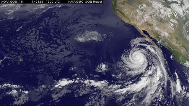
NOAA's GOES-West satellite keeps a continuous eye on the Eastern Pacific and has been covering Hurricane Marie since birth. NASA's GOES Project uses NOAA data and creates animations and did so to show the end of Hurricane Marie.
At 5 a.m. EDT (0900 UTC) on Friday, August 29, Marie became a post-tropical storm about 985 miles (1,595 km) west-southwest of San Diego, California. It was last centered near 27.6 north and 132.5 west. Marie's maximum sustained winds were near 40 mph (65 kph) and it was moving to the northwest at 14 mph (22 kph). Marie has moved over cooler waters, which has sapped evaporation and thunderstorm development.
The National Hurricane Center noted that there was no organized deep convection within the circulation of the system for many hours during the morning of August 29, so Marie had transitioned into a post-tropical cyclone.

This video of NOAA's GOES-West satellite imagery from Aug. 26-29 shows Hurricane Marie winding down into a post-tropical storm.
(Photo Credit: NASA/NOAA GOES Project)
NASA created a video of NOAA's GOES-West satellite imagery from Aug. 26-29 showed Hurricane Marie winding down into a post-tropical storm on August 29. NASA/NOAA's GOES Project is located at NASA's Goddard Space Flight Center, Greenbelt, Maryland. The animation showed that Marie's structure was blown apart and the bulk of the clouds and showers were north of the center.
While Marie continues to weaken, ocean swells are expected to subside over the next day along the west coast of the Baja California peninsula and along the coast of southern California. Life-threatening surf and rip current conditions are still likely as a result of these swells. There are no coastal watches or warnings in effect. Marie will continue to spin down into hurricane history.
Source: NASA/Goddard Space Flight Center