At 5 p.m. EDT on June 21, Beatriz had maximum sustained winds near 60 mph, and as Beatriz interacted with the mountainous terrain of Mexico its strength waned quickly.
By 11 p.m. EDT the center of circulation was no longer well-defined and maximum sustained winds dropped to 30 mph. It was a quick drop in strength over six hours and transformed Beatriz from a strong tropical storm to a weak tropical depression. At that time her center was located near 19.0 North latitude and 107.0 West longitude and moving westward near 10 mph (17 kmh).
Today, June 22, Beatriz' remnants are slowly moving over cooler sea surface temperatures. As a result, the low pressure area has a slim chance of regenerating because temperatures of at least 80 degrees Fahrenheit are needed to maintain a tropical cyclone, and these waters are near or below that threshold.
As of 8 a.m. EDT today, Beatriz' remnants were about 175 miles southwest of Cabo Corrientes, Mexico. The National Hurricane Center noted today that the chance for regeneration is now "near zero."
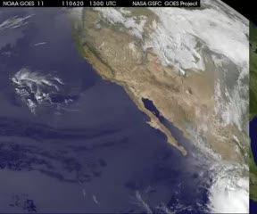
GOES-11 satellite imagery from June 20 at 13:00 UTC (9 a.m. EDT/6 a.m. PDT) until June 22 at 1315 UTC (9:15 a.m. EDT) as Beatriz battered southwestern Mexico's coastline and weakened quickly.
(Photo Credit: NASA/NOAA GOES Project, Dennis Chesters)
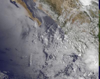
This visible image of Beatriz' remnants was taken from the GOES-11 satellite on June 22 at 13:30 UTC (9:30 a.m. EDT) and shows a disorganized clouds off the western coast of Mexico.
(Photo Credit: NASA/NOAA GOES Project, Dennis Chesters)
Source: NASA/Goddard Space Flight Center