According to the Australian Government Bureau of Meterology, "In the warm, dry and sunny winter and spring, when grasses are dead and fuels have dried, northern Australia becomes most susceptible to bushfires. Intense high-pressure systems over South Australia producing strong southeast to northeast winds increase the risk of bushfires."
Since Australia is heading into their winter as the northern climates head into summer, the north of Western Australia is ripe for bushfires. Many have already begun as evidenced from this satellite pass by NASA's Aqua satellite which acquired this image with the Moderatete Resolution Imaging Spectroradiometer (MODIS) instrument aboard it. Actively burning areas, detected by MODIS's thermal bands, are outlined in red.
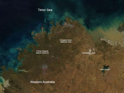
(Photo Credit: NASA image courtesy Jeff Schmaltz, MODIS Rapid Response Team. Caption: NASA/Goddard, Lynn Jenner)
NASA image courtesy Jeff Schmaltz, MODIS Rapid Response Team. Caption: NASA/Goddard, Lynn Jenner
Source: NASA/Goddard Space Flight Center