If you want to see into the future, you have to understand the past. An international consortium of researchers under the auspices of the University of Bonn has drilled deposits on the bed of Lake Van (Eastern Turkey) which provide unique insights into the last 600,000 years. The samples reveal that the climate has done its fair share of mischief-making in the past. Furthermore, there have been numerous earthquakes and volcanic eruptions. The results of the drilling project also provide a basis for assessing the risk of how dangerous natural hazards are for today's population. In a special edition of the highly regarded publication Quaternary Science Reviews, the scientists have now published their findings in a number of journal articles.
In the sediments of Lake Van, the lighter-colored, lime-containing summer layers are clearly distinguishable from the darker, clay-rich winter layers -- also called varves. In 2010, from a floating platform an international consortium of researchers drilled a 220 m deep sediment profile from the lake floor at a water depth of 360 m and analyzed the varves. The samples they recovered are a unique scientific treasure because the climate conditions, earthquakes and volcanic eruptions of the past 600,000 years can be read in outstanding quality from the cores.
The team of scientists under the auspices of the University of Bonn has analyzed some 5,000 samples in total. "The results show that the climate over the past hundred thousand years has been a roller coaster. Within just a few decades, the climate could tip from an ice age into a warm period," says Doctor Thomas Litt of the University of Bonn's Steinmann Institute and spokesman for the PALEOVAN international consortium of researchers. Unbroken continental climate archives from the ice age which encompass several hundred thousand years are extremely rare on a global scale. "There has never before in all of the Middle East and Central Asia been a continental drilling operation going so far back into the past," says Doctor Litt. In the northern hemisphere, climate data from ice-cores drilled in Greenland encompass the last 120,000 years. The Lake Van project closes a gap in the scientific climate record.

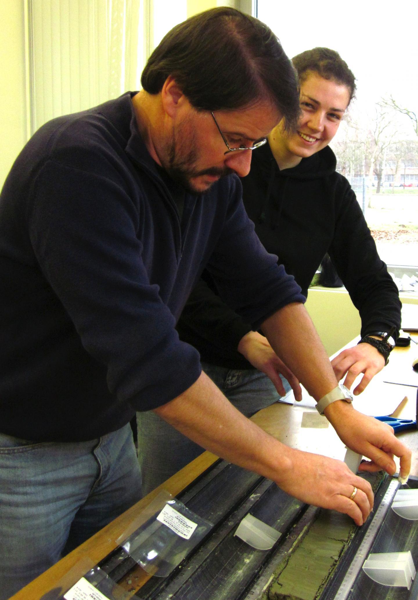
The researchers remove samples from a core segment taken from Lake Van at the center for Marine environmental sciences MARUM in Bremen, where all of the cores from the PALEOVAN project are stored.
(Photo Credit: Photo: Nadine Pickarski/Uni Bonn)
The sediments reveal six cycles of cold and warm periods
Scientists found evidence for a total of six cycles of warm and cold periods in the sediments of Lake Van. The University of Bonn paleoecologist and his colleagues analyzed the pollen preserved in the sediments. Under a microscope they were able to determine which plants around the eastern Anatolian Lake the pollen came from. "Pollen is amazingly durable and is preserved over very long periods when protected in the sediments," Doctor Litt explained. Insight into the age of the individual layers was gleaned through radiometric age measurements that use the decay of radioactive elements as a geologic clock. Based on the type of pollen and the age, the scientists were able to determine when oak forests typical of warm periods grew around Lake Van and when ice-age steppe made up of grasses, mugwort and goosefoot surrounded the lake.
Once they determine the composition of the vegetation present and the requirements of the plants, the scientists can reconstruct with a high degree of accuracy the temperature and amount of rainfall during different epochs. These analyses enable the team of researchers to read the varves of Lake Van like thousands of pages of an archive. With these data, the team was able to demonstrate that fluctuations in climate were due in large part to periodic changes in the Earth's orbit parameters and the commensurate changes in solar insolation levels. However, the influence of North Atlantic currents was also evident. "The analysis of the Lake Van sediments has presented us with an image of how an ecosystem reacts to abrupt changes in climate. This fundamental data will help us to develop potential scenarios of future climate effects," says Doctor Litt.

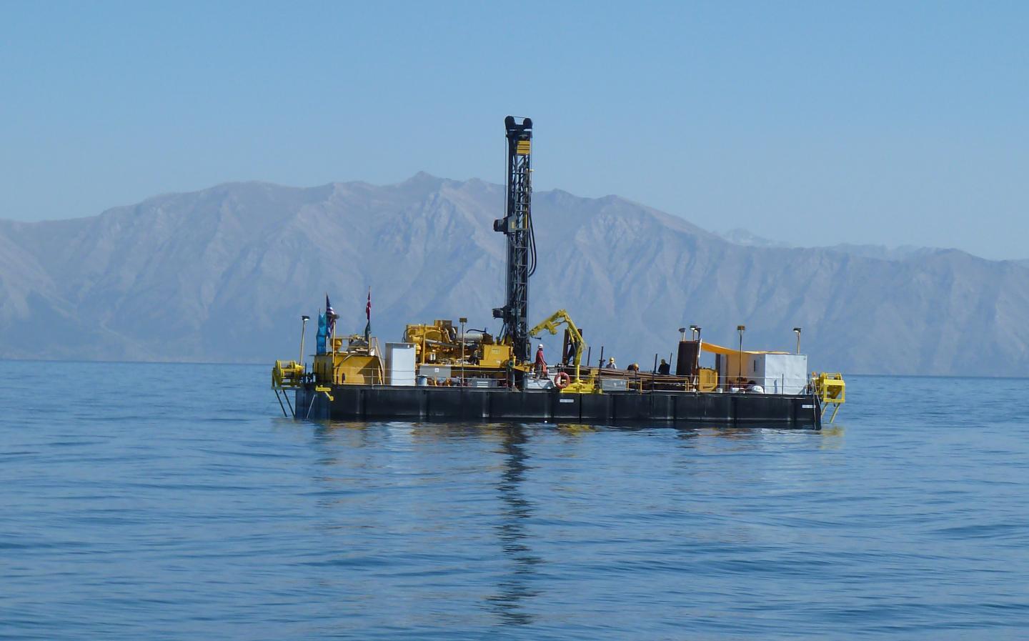
In the summer of 2010 the system was used for 10 weeks to drill samples at water depths of up to 360 m.
(Photo Credit: Photo: Thomas Litt/Uni Bonn)
Risks of earthquakes and volcanic eruptions in the region of Van
Such risk assessments can also be made for other natural forces. "Deposits of volcanic ash with thicknesses of up to 10 m in the Lake Van sediments show us that approximately 270,000 years ago there was a massive eruption," the University of Bonn paleoecologist said. The team struck some 300 different volcanic events in its drillings. Statistically, that corresponds to one explosive volcanic eruption in the region every 2000 years. Deformations in the sediment layers show that the area is subject to frequent, strong earthquakes. "The area around Lake Van is very densely populated. The data from the core samples show that volcanic activity and earthquakes present a relatively high risk for the region," Doctor Litt says. According to media reports, in 2011 a 7.2 magnitude earthquake in the Van province claimed the lives of more than 500 people and injured more than 2,500.

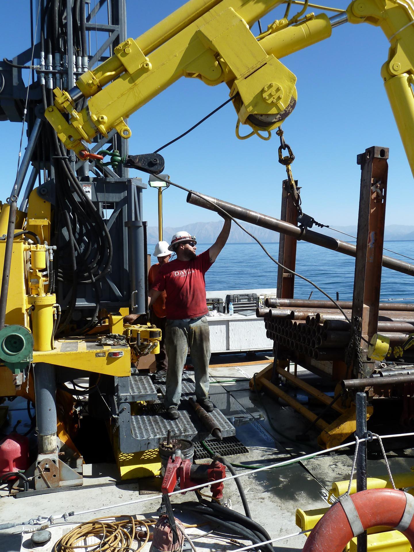
The team is at work on the platform in Lake Van.
(Photo Credit: Photo: Thomas Litt/Uni Bonn)
Source: University of Bonn